Solers geodata
Solers (Île-de-France) is a populated place; located in France in Europe/Paris (GMT+2) time zone. With population of 1,357 people, there are 6778 cities with bigger population in this country. Compared to other cities in France, 72.2% of cities are located further ↓South; 53.7% of cities are located further ←West and 62.4% of cities have higher elevation than Solers. Note1
Administrative division(s):
- Level 1: Île-de-France
- Level 2: Seine-et-Marne
- Level 3: Arrondissement de Melun
- Level 4: Solers


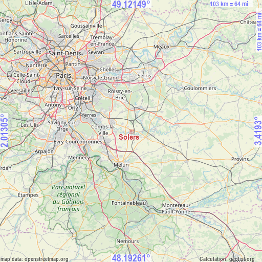
Solers GPS coordinates[2]
48° 39' 33.084" North, 2° 42' 58.212" East
| Map corner | latitude | longitude |
|---|---|---|
| Upper-left | 49.12149°, | 2.01305° |
| Center: | 48.65919°, | 2.71617° |
| Lower-right: | 48.19261°, | 3.4193° |
| Map W x H: | 103.3×103.3 km | = 64.2×64.2mi |
| max Lat: | 51.07786° ⇑27.8% North |
| Solers: | 48.65919° |
| min Lat: | ⇓72.2% South 41.3874° |
| min Long | Solers | max Long |
| -5.08615° | 2.71617° | 9.52242° |
| W 53.7%⇐ | ⇒46.3% E |
Elevation
Elevation of Solers is 96 m = 315 ft, and this is 97.7 m = 321 ft below average elevation for this country.
| Max E: |
2333 m = 7654 ft | 62.4% |
| Avg. | 193.7 m = 635 ft | |
| Solers | 96 m = 315 ft | |
Min E: |
-1 m = -3 ft | 37.6% |
See also: France elevation on elevation.city.
Geographical zone
Solers is located in North temperate zone (between Tropic of Cancer and the Arctic Circle). Distance of this North polar circle is 1990.8 km =1237 mi to North.| Distance of | km | miles | from Solers |
|---|---|---|---|
| North Pole | 4596.7 | 2856.3 | to North |
| Arctic Circle | 1990.8 | 1237 | to North |
| Tropic Cancer | 2804.5 | 1742.6 | to South |
| Equator | 5410.4 | 3361.9 | to South |


Nearby cities:
15 places around Solers: (largest is in red/bold)
• Brie-Comte-Robert
8.6 km =5.3 mi,  295°
295°
• Champdeuil
4.4 km =2.7 mi,  167°
167°
• Chevry-Cossigny
8.3 km =5.2 mi,  330°
330°
• Coubert
2 km =1.2 mi,  315°
315°
• Crisenoy
7.3 km =4.5 mi, 165°
• Grisy-Suisnes
4.6 km =2.9 mi,  309°
309°
• Guignes
6.8 km =4.2 mi,  115°
115°
• Liverdy-en-Brie
6.3 km =3.9 mi,  44°
44°
• Montereau-sur-le-Jard
8.3 km =5.2 mi,  204°
204°
• Ozouer-le-Voulgis
4.3 km =2.7 mi,  88°
88°
• Presles-en-Brie
6.5 km =4 mi,  16°
16°
• Réau
8.7 km =5.4 mi,  231°
231°
• Saint-Germain-Laxis
8.6 km =5.3 mi,  182°
182°
• Soignolles-en-Brie
1.4 km =0.9 mi,  242°
242°
• Yèbles
4.6 km =2.9 mi, 123°
Sources, notices
• [Note1] Compared only with cities in France existing in our database
• [Src1] Map data: © OpenStreetMap contributors (CC-BY-SA)
• [Src2] Other city data from geonames.org with taken over terms of usage.
• [Src3] Geographical zone / Annual Mean Temperature by Robert A. Rohde @ Wikipedia
