Ozouer-le-Voulgis geodata
Ozouer-le-Voulgis (Île-de-France) is a populated place; located in France in Europe/Paris (GMT+2) time zone. With population of 1,617 people, there are 5771 cities with bigger population in this country. Compared to other cities in France, 72.3% of cities are located further ↓South; 54.5% of cities are located further ←West and 62% of cities have higher elevation than Ozouer-le-Voulgis. Note1
Administrative division(s):
- Level 1: Île-de-France
- Level 2: Seine-et-Marne
- Level 3: Arrondissement de Melun
- Level 4: Ozouer-le-Voulgis


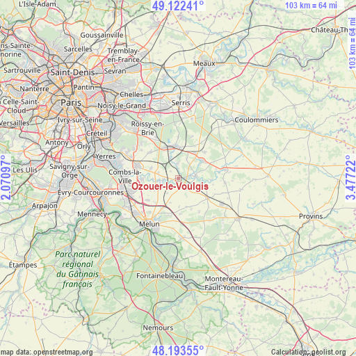
Ozouer-le-Voulgis GPS coordinates[2]
48° 39' 36.432" North, 2° 46' 26.724" East
| Map corner | latitude | longitude |
|---|---|---|
| Upper-left | 49.12241°, | 2.07097° |
| Center: | 48.66012°, | 2.77409° |
| Lower-right: | 48.19355°, | 3.47722° |
| Map W x H: | 103.3×103.3 km | = 64.2×64.2mi |
| max Lat: | 51.07786° ⇑27.7% North |
| Ozouer-le-Voulgis: | 48.66012° |
| min Lat: | ⇓72.3% South 41.3874° |
| min Long | Ozouer-le-Voulg | max Long |
| -5.08615° | 2.77409° | 9.52242° |
| W 54.5%⇐ | ⇒45.5% E |
Elevation
Elevation of Ozouer-le-Voulgis is 97 m = 318 ft, and this is 96.7 m = 317 ft below average elevation for this country.
| Max E: |
2333 m = 7654 ft | 62% |
| Avg. | 193.7 m = 635 ft | |
| Ozouer-le-Voulgis | 97 m = 318 ft | |
Min E: |
-1 m = -3 ft | 38% |
See also: France elevation on elevation.city.
Geographical zone
Ozouer-le-Voulgis is located in North temperate zone (between Tropic of Cancer and the Arctic Circle). Distance of this North polar circle is 1990.7 km =1237 mi to North.| Distance of | km | miles | from Ozouer-le-Voulgis |
|---|---|---|---|
| North Pole | 4596.6 | 2856.2 | to North |
| Arctic Circle | 1990.7 | 1237 | to North |
| Tropic Cancer | 2804.6 | 1742.7 | to South |
| Equator | 5410.5 | 3361.9 | to South |


Nearby cities:
15 places around Ozouer-le-Voulgis: (largest is in red/bold)
• Aubepierre-Ozouer-le-Repos
8.6 km =5.3 mi,  110°
110°
• Champdeuil
5.5 km =3.4 mi,  217°
217°
• Champeaux
8.7 km =5.4 mi,  164°
164°
• Chaumes-en-Brie
4.9 km =3 mi,  79°
79°
• Châtres
6.1 km =3.8 mi,  25°
25°
• Coubert
5.8 km =3.6 mi,  283°
283°
• Crisenoy
7.6 km =4.7 mi,  198°
198°
• Fouju
8.3 km =5.2 mi,  178°
178°
• Grisy-Suisnes
8.3 km =5.2 mi,  289°
289°
• Guignes
3.5 km =2.2 mi,  147°
147°
• Liverdy-en-Brie
4.4 km =2.7 mi,  1°
1°
• Presles-en-Brie
6.6 km =4.1 mi,  338°
338°
• Soignolles-en-Brie
5.5 km =3.4 mi,  262°
262°
• Solers
4.3 km =2.7 mi,  268°
268°
• Yèbles
2.7 km =1.7 mi,  189°
189°
Sources, notices
• [Note1] Compared only with cities in France existing in our database
• [Src1] Map data: © OpenStreetMap contributors (CC-BY-SA)
• [Src2] Other city data from geonames.org with taken over terms of usage.
• [Src3] Geographical zone / Annual Mean Temperature by Robert A. Rohde @ Wikipedia
