Champagné-Saint-Hilaire geodata
Champagné-Saint-Hilaire (Nouvelle-Aquitaine) is a populated place; located in France in Europe/Paris (GMT+2) time zone. With population of 925 people, there are 9431 cities with bigger population in this country. Compared to other cities in France, 62.1% of cities are located further ↑North; 75.1% of cities are located further →East and 61.6% of cities have lower elevation than Champagné-Saint-Hilaire. Note1
Administrative division(s):
- Level 1: Nouvelle-Aquitaine
- Level 2: Vienne
- Level 3: Arrondissement de Montmorillon
- Level 4: Champagné-Saint-Hilaire
Current local time in Champagné-Saint-Hilaire:
11:30 AM, SaturdayDifference from your time zone: hours


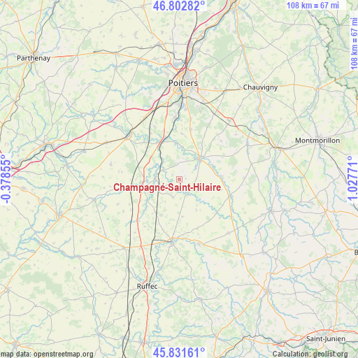
Champagné-Saint-Hilaire GPS coordinates[2]
46° 19' 9.732" North, 0° 19' 28.488" East
| Map corner | latitude | longitude |
|---|---|---|
| Upper-left | 46.80282°, | -0.37855° |
| Center: | 46.31937°, | 0.32458° |
| Lower-right: | 45.83161°, | 1.02771° |
| Map W x H: | 108×108 km | = 67.1×67.1mi |
| max Lat: | 51.07786° ⇑62.1% North |
| Champagné-Saint-Hilaire: | 46.31937° |
| min Lat: | ⇓37.9% South 41.3874° |
| min Long | Champagné-Sain | max Long |
| -5.08615° | 0.32458° | 9.52242° |
| W 24.9%⇐ | ⇒75.1% E |
Elevation
Elevation of Champagné-Saint-Hilaire is 178 m = 584 ft, and this is 15.7 m = 52 ft below average elevation for this country.
| Max E: |
2333 m = 7654 ft | 38.4% |
| Avg. | 193.7 m = 635 ft | |
| Champagné-Saint-Hilaire | 178 m = 584 ft | |
Min E: |
-1 m = -3 ft | 61.6% |
See also: France elevation on elevation.city.
Geographical zone
Champagné-Saint-Hilaire is located in North temperate zone (between Tropic of Cancer and the Arctic Circle). Distance of this North polar circle is 2250.9 km =1398.6 mi to North.| Distance of | km | miles | from Champagné-Saint-Hilaire |
|---|---|---|---|
| North Pole | 4856.8 | 3017.9 | to North |
| Arctic Circle | 2250.9 | 1398.6 | to North |
| Tropic Cancer | 2544.3 | 1581 | to South |
| Equator | 5150.2 | 3200.2 | to South |


Nearby cities:
15 places around Champagné-Saint-Hilaire: (largest is in red/bold)
• Aslonnes
9 km =5.6 mi,  4°
4°
• Brux
13.7 km =8.5 mi,  227°
227°
• Ceaux-en-Couhé
7 km =4.3 mi,  267°
267°
• Château-Garnier
10.3 km =6.4 mi,  131°
131°
• Château-Larcher
10.9 km =6.8 mi,  355°
355°
• Couhé
11.2 km =7 mi,  258°
258°
• Magné
6.7 km =4.2 mi,  51°
51°
• Marnay
8.6 km =5.3 mi,  8°
8°
• Payré
9 km =5.6 mi,  285°
285°
• Romagne
5.7 km =3.5 mi,  197°
197°
• Saint-Maurice-la-Clouère
9.5 km =5.9 mi, 45°
• Saint-Secondin
12.9 km =8 mi,  85°
85°
• Sommières-du-Clain
5.2 km =3.2 mi,  149°
149°
• Vaux
8.3 km =5.2 mi,  253°
253°
• Vivonne
13.1 km =8.1 mi,  339°
339°
Sources, notices
• [Note1] Compared only with cities in France existing in our database
• [Src1] Map data: © OpenStreetMap contributors (CC-BY-SA)
• [Src2] Other city data from geonames.org with taken over terms of usage.
• [Src3] Geographical zone / Annual Mean Temperature by Robert A. Rohde @ Wikipedia
