Brux geodata
Brux (Nouvelle-Aquitaine) is a populated place; located in France in Europe/Paris (GMT+2) time zone. With population of 721 people, there are 11522 cities with bigger population in this country. Compared to other cities in France, 63.1% of cities are located further ↑North; 76.3% of cities are located further →East and 51.4% of cities have higher elevation than Brux. Note1
Administrative division(s):
- Level 1: Nouvelle-Aquitaine
- Level 2: Vienne
- Level 3: Arrondissement de Montmorillon
- Level 4: Brux


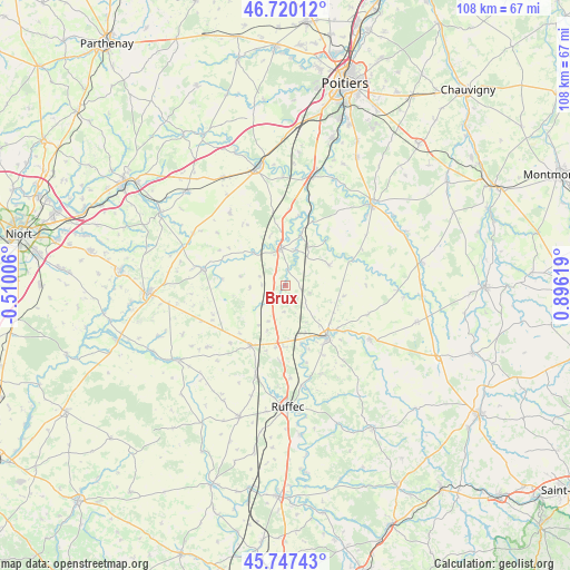
Brux GPS coordinates[2]
46° 14' 9.348" North, 0° 11' 35.016" East
| Map corner | latitude | longitude |
|---|---|---|
| Upper-left | 46.72012°, | -0.51006° |
| Center: | 46.23593°, | 0.19306° |
| Lower-right: | 45.74743°, | 0.89619° |
| Map W x H: | 108.2×108.2 km | = 67.2×67.2mi |
| max Lat: | 51.07786° ⇑63.1% North |
| Brux: | 46.23593° |
| min Lat: | ⇓36.9% South 41.3874° |
| min Long | Brux | max Long |
| -5.08615° | 0.19306° | 9.52242° |
| W 23.7%⇐ | ⇒76.3% E |
Elevation
Elevation of Brux is 127 m = 417 ft, and this is 66.7 m = 219 ft below average elevation for this country.
| Max E: |
2333 m = 7654 ft | 51.4% |
| Avg. | 193.7 m = 635 ft | |
| Brux | 127 m = 417 ft | |
Min E: |
-1 m = -3 ft | 48.6% |
See also: France elevation on elevation.city.
Geographical zone
Brux is located in North temperate zone (between Tropic of Cancer and the Arctic Circle). Distance of this North polar circle is 2260.2 km =1404.4 mi to North.| Distance of | km | miles | from Brux |
|---|---|---|---|
| North Pole | 4866.1 | 3023.7 | to North |
| Arctic Circle | 2260.2 | 1404.4 | to North |
| Tropic Cancer | 2535 | 1575.2 | to South |
| Equator | 5141 | 3194.5 | to South |


Nearby cities:
15 places around Brux: (largest is in red/bold)
• Blanzay
6.1 km =3.8 mi,  128°
128°
• Ceaux-en-Couhé
9.5 km =5.9 mi,  19°
19°
• Champagné-Saint-Hilaire
13.7 km =8.5 mi,  47°
47°
• Chaunay
3.9 km =2.4 mi,  214°
214°
• Civray
12.5 km =7.8 mi,  141°
141°
• Clussais
12 km =7.5 mi,  248°
248°
• Couhé
7.2 km =4.5 mi,  353°
353°
• Limalonges
11.9 km =7.4 mi,  188°
188°
• Payré
11.8 km =7.3 mi,  6°
6°
• Rom
8.7 km =5.4 mi,  316°
316°
• Romagne
9.2 km =5.7 mi,  65°
65°
• Sauzé-Vaussais
13.1 km =8.1 mi, 210°
• Savigné
13 km =8.1 mi, 130°
• Sommières-du-Clain
13.6 km =8.5 mi, 69°
• Vaux
7.3 km =4.5 mi, 17°
Sources, notices
• [Note1] Compared only with cities in France existing in our database
• [Src1] Map data: © OpenStreetMap contributors (CC-BY-SA)
• [Src2] Other city data from geonames.org with taken over terms of usage.
• [Src3] Geographical zone / Annual Mean Temperature by Robert A. Rohde @ Wikipedia
