Chalampé geodata
Chalampé (Grand Est) is a populated place; located in France in Europe/Paris (GMT+2) time zone. With population of 1,018 people, there are 8707 cities with bigger population in this country. Compared to other cities in France, 56.1% of cities are located further ↓South; 98.3% of cities are located further ←West and 68.8% of cities have lower elevation than Chalampé. Note1
Administrative division(s):
- Level 1: Grand Est
- Level 2: Haut-Rhin
- Level 3: Arrondissement de Mulhouse
- Level 4: Chalampé


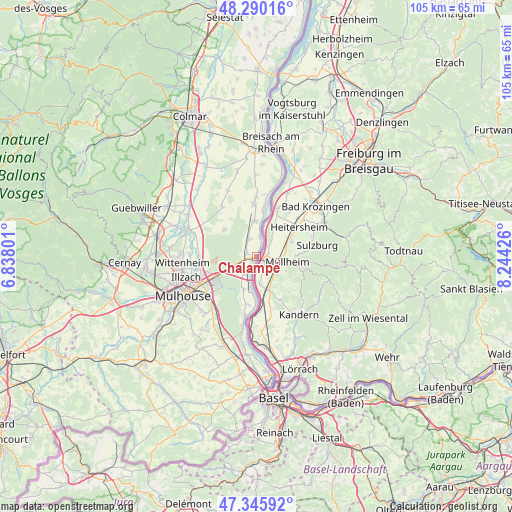
Chalampé GPS coordinates[2]
47° 49' 12.684" North, 7° 32' 28.068" East
| Map corner | latitude | longitude |
|---|---|---|
| Upper-left | 48.29016°, | 6.83801° |
| Center: | 47.82019°, | 7.54113° |
| Lower-right: | 47.34592°, | 8.24426° |
| Map W x H: | 105×105 km | = 65.2×65.2mi |
| max Lat: | 51.07786° ⇑43.9% North |
| Chalampé: | 47.82019° |
| min Lat: | ⇓56.1% South 41.3874° |
| min Long | Chalampé | max Long |
| -5.08615° | 7.54113° | 9.52242° |
| W 98.3%⇐ | ⇒1.7% E |
Elevation
Elevation of Chalampé is 213 m = 699 ft, and this is 19.3 m = 63 ft above average elevation for this country.
| Max E: |
2333 m = 7654 ft | 31.2% |
| Chalampé | 213 m 699 ft | |
| Avg. | 193.7 m = 635 ft | |
Min E: |
-1 m = -3 ft | 68.8% |
See also: France elevation on elevation.city.
Geographical zone
Chalampé is located in North temperate zone (between Tropic of Cancer and the Arctic Circle). Distance of this North polar circle is 2084.1 km =1295 mi to North.| Distance of | km | miles | from Chalampé |
|---|---|---|---|
| North Pole | 4690 | 2914.2 | to North |
| Arctic Circle | 2084.1 | 1295 | to North |
| Tropic Cancer | 2711.2 | 1684.7 | to South |
| Equator | 5317.1 | 3303.9 | to South |


Nearby cities:
15 places around Chalampé: (largest is in red/bold)
• Baldersheim
12.2 km =7.6 mi,  260°
260°
• Balgau
12 km =7.5 mi,  359°
359°
• Bantzenheim
2 km =1.2 mi,  283°
283°
• Battenheim
11.9 km =7.4 mi,  269°
269°
• Blodelsheim
7.3 km =4.5 mi, 357°
• Fessenheim
10.6 km =6.6 mi, 357°
• Hirtzfelden
12.4 km =7.7 mi,  325°
325°
• Hombourg
7.2 km =4.5 mi,  200°
200°
• Munchhouse
8.6 km =5.3 mi,  309°
309°
• Niffer
12.1 km =7.5 mi,  191°
191°
• Ottmarsheim
4.4 km =2.7 mi,  214°
214°
• Petit-Landau
10.1 km =6.3 mi, 189°
• Rixheim
13 km =8.1 mi,  232°
232°
• Rumersheim-le-Haut
3.8 km =2.4 mi,  336°
336°
• Sausheim
13.1 km =8.1 mi,  253°
253°
Sources, notices
• [Note1] Compared only with cities in France existing in our database
• [Src1] Map data: © OpenStreetMap contributors (CC-BY-SA)
• [Src2] Other city data from geonames.org with taken over terms of usage.
• [Src3] Geographical zone / Annual Mean Temperature by Robert A. Rohde @ Wikipedia
