Battenheim geodata
Battenheim (Grand Est) is a populated place; located in France in Europe/Paris (GMT+2) time zone. With population of 1,382 people, there are 6675 cities with bigger population in this country. Compared to other cities in France, 56.1% of cities are located further ↓South; 97.1% of cities are located further ←West and 71.2% of cities have lower elevation than Battenheim. Note1
Administrative division(s):
- Level 1: Grand Est
- Level 2: Haut-Rhin
- Level 3: Arrondissement de Mulhouse
- Level 4: Battenheim


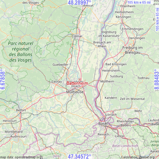
Battenheim GPS coordinates[2]
47° 49' 11.964" North, 7° 22' 54.12" East
| Map corner | latitude | longitude |
|---|---|---|
| Upper-left | 48.28997°, | 6.67858° |
| Center: | 47.81999°, | 7.3817° |
| Lower-right: | 47.34572°, | 8.08483° |
| Map W x H: | 105×105 km | = 65.2×65.2mi |
| max Lat: | 51.07786° ⇑43.9% North |
| Battenheim: | 47.81999° |
| min Lat: | ⇓56.1% South 41.3874° |
| min Long | Battenheim | max Long |
| -5.08615° | 7.3817° | 9.52242° |
| W 97.1%⇐ | ⇒2.9% E |
Elevation
Elevation of Battenheim is 225 m = 738 ft, and this is 31.3 m = 103 ft above average elevation for this country.
| Max E: |
2333 m = 7654 ft | 28.8% |
| Battenheim | 225 m 738 ft | |
| Avg. | 193.7 m = 635 ft | |
Min E: |
-1 m = -3 ft | 71.2% |
See also: France elevation on elevation.city.
Geographical zone
Battenheim is located in North temperate zone (between Tropic of Cancer and the Arctic Circle). Distance of this North polar circle is 2084.1 km =1295 mi to North.| Distance of | km | miles | from Battenheim |
|---|---|---|---|
| North Pole | 4690 | 2914.2 | to North |
| Arctic Circle | 2084.1 | 1295 | to North |
| Tropic Cancer | 2711.2 | 1684.7 | to South |
| Equator | 5317.1 | 3303.9 | to South |


Nearby cities:
15 places around Battenheim: (largest is in red/bold)
• Baldersheim
2.1 km =1.3 mi,  181°
181°
• Ensisheim
5.6 km =3.5 mi,  335°
335°
• Illzach
5.6 km =3.5 mi,  203°
203°
• Kingersheim
5.2 km =3.2 mi,  231°
231°
• Mulhouse
8.5 km =5.3 mi,  207°
207°
• Munchhouse
7.6 km =4.7 mi,  43°
43°
• Pfastatt
8.2 km =5.1 mi, 226°
• Pulversheim
6.3 km =3.9 mi,  287°
287°
• Riedisheim
8 km =5 mi,  187°
187°
• Rixheim
8 km =5 mi,  169°
169°
• Ruelisheim
1.9 km =1.2 mi,  283°
283°
• Réguisheim
8.7 km =5.4 mi,  345°
345°
• Sausheim
3.7 km =2.3 mi, 190°
• Ungersheim
8.5 km =5.3 mi,  319°
319°
• Wittenheim
4.2 km =2.6 mi,  255°
255°
Sources, notices
• [Note1] Compared only with cities in France existing in our database
• [Src1] Map data: © OpenStreetMap contributors (CC-BY-SA)
• [Src2] Other city data from geonames.org with taken over terms of usage.
• [Src3] Geographical zone / Annual Mean Temperature by Robert A. Rohde @ Wikipedia
