Chabeuil geodata
Chabeuil (Auvergne-Rhône-Alpes) is a populated place; located in France in Europe/Paris (GMT+2) time zone. With population of 6,302 people, there are 1572 cities with bigger population in this country. Compared to other cities in France, 80.5% of cities are located further ↑North; 77.8% of cities are located further ←West and 69% of cities have lower elevation than Chabeuil. Note1
Administrative division(s):
- Level 1: Auvergne-Rhône-Alpes
- Level 2: Département de la Drôme
- Level 3: Arrondissement de Valence
- Level 4: Chabeuil


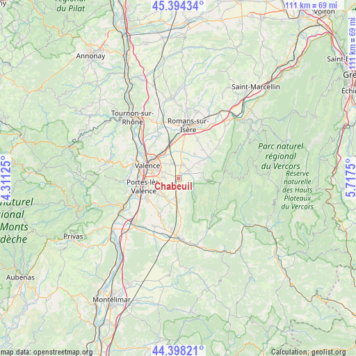
Chabeuil GPS coordinates[2]
44° 53' 54.348" North, 5° 0' 51.768" East
| Map corner | latitude | longitude |
|---|---|---|
| Upper-left | 45.39434°, | 4.31125° |
| Center: | 44.89843°, | 5.01438° |
| Lower-right: | 44.39821°, | 5.7175° |
| Map W x H: | 110.8×110.8 km | = 68.8×68.8mi |
| max Lat: | 51.07786° ⇑80.5% North |
| Chabeuil: | 44.89843° |
| min Lat: | ⇓19.5% South 41.3874° |
| min Long | Chabeuil | max Long |
| -5.08615° | 5.01438° | 9.52242° |
| W 77.8%⇐ | ⇒22.2% E |
Elevation
Elevation of Chabeuil is 214 m = 702 ft, and this is 20.3 m = 67 ft above average elevation for this country.
| Max E: |
2333 m = 7654 ft | 31% |
| Chabeuil | 214 m 702 ft | |
| Avg. | 193.7 m = 635 ft | |
Min E: |
-1 m = -3 ft | 69% |
See also: France elevation on elevation.city.
Geographical zone
Chabeuil is located in North temperate zone (between Tropic of Cancer and the Arctic Circle). Distance of this Northern Tropic circle is 2386.3 km =1482.8 mi to South.| Distance of | km | miles | from Chabeuil |
|---|---|---|---|
| North Pole | 5014.8 | 3116.1 | to North |
| Arctic Circle | 2408.9 | 1496.8 | to North |
| Tropic Cancer | 2386.3 | 1482.8 | to South |
| Equator | 4992.2 | 3102 | to South |


Nearby cities:
15 places around Chabeuil: (largest is in red/bold)
• Alixan
8.5 km =5.3 mi,  7°
7°
• Beaumont-lès-Valence
6.9 km =4.3 mi,  234°
234°
• Beauvallon
9.7 km =6 mi,  240°
240°
• Bourg-lès-Valence
10.9 km =6.8 mi,  299°
299°
• Bésayes
9 km =5.6 mi,  32°
32°
• Charpey
7.6 km =4.7 mi,  54°
54°
• Châteaudouble
6.2 km =3.9 mi,  89°
89°
• Malissard
4.8 km =3 mi,  271°
271°
• Montmeyran
7.9 km =4.9 mi,  205°
205°
• Montvendre
3.2 km =2 mi,  164°
164°
• Montélier
4.2 km =2.6 mi,  18°
18°
• Montéléger
8 km =5 mi, 230°
• Peyrus
7.2 km =4.5 mi,  77°
77°
• Saint-Marcel-lès-Valence
9.4 km =5.8 mi,  329°
329°
• Valence
8.8 km =5.5 mi,  290°
290°
Sources, notices
• [Note1] Compared only with cities in France existing in our database
• [Src1] Map data: © OpenStreetMap contributors (CC-BY-SA)
• [Src2] Other city data from geonames.org with taken over terms of usage.
• [Src3] Geographical zone / Annual Mean Temperature by Robert A. Rohde @ Wikipedia
