Cerisy-la-Forêt geodata
Cerisy-la-Forêt (Normandy) is a populated place; located in France in Europe/Paris (GMT+2) time zone. With population of 853 people, there are 10054 cities with bigger population in this country. Compared to other cities in France, 84.2% of cities are located further ↓South; 87.6% of cities are located further →East and 66% of cities have higher elevation than Cerisy-la-Forêt. Note1
Administrative division(s):
- Level 1: Normandy
- Level 2: Manche
- Level 3: Arrondissement de Saint-Lô
- Level 4: Cerisy-la-Forêt


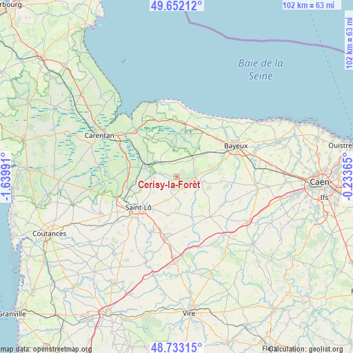
Cerisy-la-Forêt GPS coordinates[2]
49° 11' 41.172" North, 0° 56' 12.408" West
| Map corner | latitude | longitude |
|---|---|---|
| Upper-left | 49.65212°, | -1.63991° |
| Center: | 49.19477°, | -0.93678° |
| Lower-right: | 48.73315°, | -0.23365° |
| Map W x H: | 102.2×102.2 km | = 63.5×63.5mi |
| max Lat: | 51.07786° ⇑15.8% North |
| Cerisy-la-Forêt: | 49.19477° |
| min Lat: | ⇓84.2% South 41.3874° |
| min Long | Cerisy-la-Forê | max Long |
| -5.08615° | -0.93678° | 9.52242° |
| W 12.4%⇐ | ⇒87.6% E |
Elevation
Elevation of Cerisy-la-Forêt is 87 m = 285 ft, and this is 106.7 m = 350 ft below average elevation for this country.
| Max E: |
2333 m = 7654 ft | 66% |
| Avg. | 193.7 m = 635 ft | |
| Cerisy-la-Forêt | 87 m = 285 ft | |
Min E: |
-1 m = -3 ft | 34% |
See also: France elevation on elevation.city.
Geographical zone
Cerisy-la-Forêt is located in North temperate zone (between Tropic of Cancer and the Arctic Circle). Distance of this North polar circle is 1931.2 km =1200 mi to North.| Distance of | km | miles | from Cerisy-la-Forêt |
|---|---|---|---|
| North Pole | 4537.1 | 2819.2 | to North |
| Arctic Circle | 1931.2 | 1200 | to North |
| Tropic Cancer | 2864 | 1779.6 | to South |
| Equator | 5469.9 | 3398.8 | to South |


Nearby cities:
15 places around Cerisy-la-Forêt: (largest is in red/bold)
• Balleroy
7.3 km =4.5 mi,  101°
101°
• La Barre-de-Semilly
11.6 km =7.2 mi,  217°
217°
• La Meauffe
12.8 km =8 mi,  260°
260°
• Le Molay-Littry
7.1 km =4.4 mi,  41°
41°
• Le Tronquay
9.2 km =5.7 mi,  67°
67°
• Moon-sur-Elle
8.2 km =5.1 mi,  279°
279°
• Pont-Hébert
14.7 km =9.1 mi, 257°
• Saint-Clair-sur-l'Elle
6.7 km =4.2 mi,  268°
268°
• Saint-Fromond
11.5 km =7.1 mi, 284°
• Saint-Georges-Montcocq
13.6 km =8.5 mi,  236°
236°
• Saint-Jean-des-Baisants
11.5 km =7.1 mi,  193°
193°
• Saint-Lô
14.2 km =8.8 mi,  231°
231°
• Saint-Paul-du-Vernay
12.8 km =8 mi,  93°
93°
• Subles
14.4 km =8.9 mi, 69°
• Trévières
12.9 km =8 mi,  10°
10°
Sources, notices
• [Note1] Compared only with cities in France existing in our database
• [Src1] Map data: © OpenStreetMap contributors (CC-BY-SA)
• [Src2] Other city data from geonames.org with taken over terms of usage.
• [Src3] Geographical zone / Annual Mean Temperature by Robert A. Rohde @ Wikipedia
