Caulnes geodata
Caulnes (Brittany) is a populated place; located in France in Europe/Paris (GMT+2) time zone. With population of 2,320 people, there are 4162 cities with bigger population in this country. Compared to other cities in France, 64.4% of cities are located further ↓South; 95.4% of cities are located further →East and 70.1% of cities have higher elevation than Caulnes. Note1
Administrative division(s):
- Level 1: Brittany
- Level 2: Département des Côtes-d’Armor
- Level 3: Arrondissement de Dinan
- Level 4: Caulnes


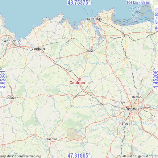
Caulnes GPS coordinates[2]
48° 17' 16.944" North, 2° 9' 18.648" West
| Map corner | latitude | longitude |
|---|---|---|
| Upper-left | 48.75375°, | -2.85831° |
| Center: | 48.28804°, | -2.15518° |
| Lower-right: | 47.81805°, | -1.45206° |
| Map W x H: | 104×104 km | = 64.6×64.6mi |
| max Lat: | 51.07786° ⇑35.6% North |
| Caulnes: | 48.28804° |
| min Lat: | ⇓64.4% South 41.3874° |
| min Long | Caulnes | max Long |
| -5.08615° | -2.15518° | 9.52242° |
| W 4.6%⇐ | ⇒95.4% E |
Elevation
Elevation of Caulnes is 78 m = 256 ft, and this is 115.7 m = 380 ft below average elevation for this country.
| Max E: |
2333 m = 7654 ft | 70.1% |
| Avg. | 193.7 m = 635 ft | |
| Caulnes | 78 m = 256 ft | |
Min E: |
-1 m = -3 ft | 29.9% |
See also: France elevation on elevation.city.
Geographical zone
Caulnes is located in North temperate zone (between Tropic of Cancer and the Arctic Circle). Distance of this North polar circle is 2032 km =1262.6 mi to North.| Distance of | km | miles | from Caulnes |
|---|---|---|---|
| North Pole | 4637.9 | 2881.9 | to North |
| Arctic Circle | 2032 | 1262.6 | to North |
| Tropic Cancer | 2763.2 | 1717 | to South |
| Equator | 5369.1 | 3336.2 | to South |


Nearby cities:
15 places around Caulnes: (largest is in red/bold)
• Broons
8.4 km =5.2 mi,  292°
292°
• Brusvily
11.6 km =7.2 mi,  10°
10°
• Guitté
4.5 km =2.8 mi,  77°
77°
• Lanrelas
11.5 km =7.1 mi,  248°
248°
• Médréac
7 km =4.3 mi,  109°
109°
• Mégrit
11.9 km =7.4 mi,  324°
324°
• Plouasne
11.1 km =6.9 mi, 82°
• Plumaudan
8 km =5 mi,  16°
16°
• Plumaugat
7.2 km =4.5 mi,  239°
239°
• Quédillac
4.4 km =2.7 mi,  167°
167°
• Saint-Juvat
11 km =6.8 mi,  48°
48°
• Saint-Méen-le-Grand
11.3 km =7 mi,  195°
195°
• Saint-Onen-la-Chapelle
12.4 km =7.7 mi,  186°
186°
• Trémeur
10.4 km =6.5 mi,  308°
308°
• Yvignac-la-Tour
7.2 km =4.5 mi,  343°
343°
Sources, notices
• [Note1] Compared only with cities in France existing in our database
• [Src1] Map data: © OpenStreetMap contributors (CC-BY-SA)
• [Src2] Other city data from geonames.org with taken over terms of usage.
• [Src3] Geographical zone / Annual Mean Temperature by Robert A. Rohde @ Wikipedia
