Cassel geodata
Cassel (Hauts-de-France) is a populated place; located in France in Europe/Paris (GMT+2) time zone. With population of 2,438 people, there are 3972 cities with bigger population in this country. Compared to other cities in France, 99.3% of cities are located further ↓South; 50.3% of cities are located further ←West and 59.1% of cities have lower elevation than Cassel. Note1
Administrative division(s):
- Level 1: Hauts-de-France
- Level 2: Nord
- Level 3: Arrondissement de Dunkerque
- Level 4: Cassel


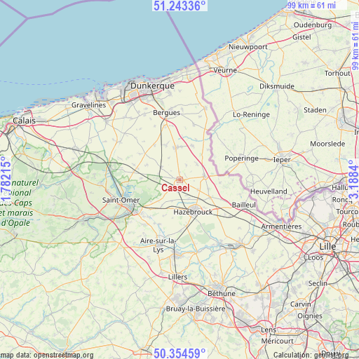
Cassel GPS coordinates[2]
50° 48' 3.924" North, 2° 29' 6.972" East
| Map corner | latitude | longitude |
|---|---|---|
| Upper-left | 51.24336°, | 1.78215° |
| Center: | 50.80109°, | 2.48527° |
| Lower-right: | 50.35459°, | 3.1884° |
| Map W x H: | 98.8×98.8 km | = 61.4×61.4mi |
| max Lat: | 51.07786° ⇑0.7% North |
| Cassel: | 50.80109° |
| min Lat: | ⇓99.3% South 41.3874° |
| min Long | Cassel | max Long |
| -5.08615° | 2.48527° | 9.52242° |
| W 50.3%⇐ | ⇒49.7% E |
Elevation
Elevation of Cassel is 166 m = 545 ft, and this is 27.7 m = 91 ft below average elevation for this country.
| Max E: |
2333 m = 7654 ft | 40.9% |
| Avg. | 193.7 m = 635 ft | |
| Cassel | 166 m = 545 ft | |
Min E: |
-1 m = -3 ft | 59.1% |
See also: France elevation on elevation.city.
Geographical zone
Cassel is located in North temperate zone (between Tropic of Cancer and the Arctic Circle). Distance of this North polar circle is 1752.6 km =1089 mi to North.| Distance of | km | miles | from Cassel |
|---|---|---|---|
| North Pole | 4358.5 | 2708.2 | to North |
| Arctic Circle | 1752.6 | 1089 | to North |
| Tropic Cancer | 3042.6 | 1890.6 | to South |
| Equator | 5648.6 | 3509.9 | to South |


Nearby cities:
15 places around Cassel: (largest is in red/bold)
• Arnèke
6.4 km =4 mi,  302°
302°
• Bavinchove
2.6 km =1.6 mi,  230°
230°
• Eecke
8.2 km =5.1 mi,  107°
107°
• Hondeghem
5.6 km =3.5 mi,  153°
153°
• Ledringhem
6.8 km =4.2 mi,  333°
333°
• Noordpeene
6 km =3.7 mi,  276°
276°
• Oudezeele
4.5 km =2.8 mi,  22°
22°
• Saint-Sylvestre-Cappel
5.7 km =3.5 mi,  118°
118°
• Sainte-Marie-Cappel
2.4 km =1.5 mi,  140°
140°
• Staple
6.2 km =3.9 mi,  200°
200°
• Steenvoorde
6.9 km =4.3 mi,  81°
81°
• Terdeghem
3.8 km =2.4 mi,  93°
93°
• Wallon-Cappel
8.3 km =5.2 mi,  185°
185°
• Winnezeele
6.4 km =4 mi,  46°
46°
• Wormhout
9 km =5.6 mi,  352°
352°
Sources, notices
• [Note1] Compared only with cities in France existing in our database
• [Src1] Map data: © OpenStreetMap contributors (CC-BY-SA)
• [Src2] Other city data from geonames.org with taken over terms of usage.
• [Src3] Geographical zone / Annual Mean Temperature by Robert A. Rohde @ Wikipedia
