Bussac-sur-Charente geodata
Bussac-sur-Charente (Nouvelle-Aquitaine) is a populated place; located in France in Europe/Paris (GMT+2) time zone. With population of 1,215 people, there are 7453 cities with bigger population in this country. Compared to other cities in France, 69.5% of cities are located further ↑North; 84.8% of cities are located further →East and 97% of cities have higher elevation than Bussac-sur-Charente. Note1
Administrative division(s):
- Level 1: Nouvelle-Aquitaine
- Level 2: Charente-Maritime
- Level 3: Arrondissement de Saintes
- Level 4: Bussac-sur-Charente


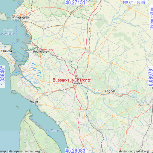
Bussac-sur-Charente GPS coordinates[2]
45° 46' 59.988" North, 0° 37' 59.988" West
| Map corner | latitude | longitude |
|---|---|---|
| Upper-left | 46.27151°, | -1.33646° |
| Center: | 45.78333°, | -0.63333° |
| Lower-right: | 45.29083°, | 0.06979° |
| Map W x H: | 109×109 km | = 67.7×67.7mi |
| max Lat: | 51.07786° ⇑69.5% North |
| Bussac-sur-Charente: | 45.78333° |
| min Lat: | ⇓30.5% South 41.3874° |
| min Long | Bussac-sur-Char | max Long |
| -5.08615° | -0.63333° | 9.52242° |
| W 15.2%⇐ | ⇒84.8% E |
Elevation
Elevation of Bussac-sur-Charente is 11 m = 36 ft, and this is 182.7 m = 599 ft below average elevation for this country.
| Max E: |
2333 m = 7654 ft | 97% |
| Avg. | 193.7 m = 635 ft | |
| Bussac-sur-Charente | 11 m = 36 ft | |
Min E: |
-1 m = -3 ft | 3% |
See also: France elevation on elevation.city.
Geographical zone
Bussac-sur-Charente is located in North temperate zone (between Tropic of Cancer and the Arctic Circle). Distance of this North polar circle is 2310.5 km =1435.7 mi to North.| Distance of | km | miles | from Bussac-sur-Charente |
|---|---|---|---|
| North Pole | 4916.4 | 3054.9 | to North |
| Arctic Circle | 2310.5 | 1435.7 | to North |
| Tropic Cancer | 2484.7 | 1543.9 | to South |
| Equator | 5090.6 | 3163.2 | to South |


Nearby cities:
15 places around Bussac-sur-Charente: (largest is in red/bold)
• Chaniers
9.3 km =5.8 mi,  140°
140°
• Courcoury
9 km =5.6 mi,  152°
152°
• Fontcouverte
4 km =2.5 mi,  116°
116°
• La Chapelle-des-Pots
7.6 km =4.7 mi,  110°
110°
• Le Douhet
6.7 km =4.2 mi,  50°
50°
• Les Essards
9.8 km =6.1 mi,  275°
275°
• Les Gonds
7.8 km =4.8 mi,  168°
168°
• Nieul-lès-Saintes
8 km =5 mi,  251°
251°
• Pessines
9 km =5.6 mi,  226°
226°
• Plassay
8.1 km =5 mi,  298°
298°
• Saint-Georges-des-Coteaux
6.7 km =4.2 mi, 254°
• Saintes
4.2 km =2.6 mi,  181°
181°
• Taillebourg
5.7 km =3.5 mi,  350°
350°
• Vénérand
6 km =3.7 mi,  79°
79°
• Écoyeux
10.8 km =6.7 mi,  66°
66°
Sources, notices
• [Note1] Compared only with cities in France existing in our database
• [Src1] Map data: © OpenStreetMap contributors (CC-BY-SA)
• [Src2] Other city data from geonames.org with taken over terms of usage.
• [Src3] Geographical zone / Annual Mean Temperature by Robert A. Rohde @ Wikipedia
