Écoyeux geodata
Écoyeux (Nouvelle-Aquitaine) is a populated place; located in France in Europe/Paris (GMT+2) time zone. With population of 1,008 people, there are 8781 cities with bigger population in this country. Compared to other cities in France, 69% of cities are located further ↑North; 83.5% of cities are located further →East and 79.4% of cities have higher elevation than Écoyeux. Note1
Administrative division(s):
- Level 1: Nouvelle-Aquitaine
- Level 2: Charente-Maritime
- Level 3: Arrondissement de Saintes
- Level 4: Écoyeux


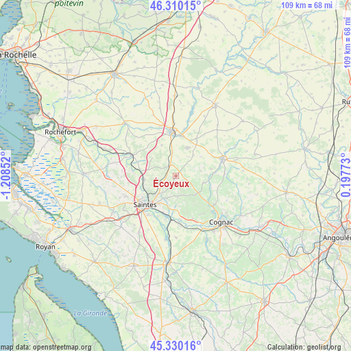
Écoyeux GPS coordinates[2]
45° 49' 20.316" North, 0° 30' 19.404" West
| Map corner | latitude | longitude |
|---|---|---|
| Upper-left | 46.31015°, | -1.20852° |
| Center: | 45.82231°, | -0.50539° |
| Lower-right: | 45.33016°, | 0.19773° |
| Map W x H: | 109×109 km | = 67.7×67.7mi |
| max Lat: | 51.07786° ⇑69% North |
| Écoyeux: | 45.82231° |
| min Lat: | ⇓31% South 41.3874° |
| min Long | Écoyeux | max Long |
| -5.08615° | -0.50539° | 9.52242° |
| W 16.5%⇐ | ⇒83.5% E |
Elevation
Elevation of Écoyeux is 56 m = 184 ft, and this is 137.7 m = 452 ft below average elevation for this country.
| Max E: |
2333 m = 7654 ft | 79.4% |
| Avg. | 193.7 m = 635 ft | |
| Écoyeux | 56 m = 184 ft | |
Min E: |
-1 m = -3 ft | 20.6% |
See also: France elevation on elevation.city.
Geographical zone
Écoyeux is located in North temperate zone (between Tropic of Cancer and the Arctic Circle). Distance of this North polar circle is 2306.2 km =1433 mi to North.| Distance of | km | miles | from Écoyeux |
|---|---|---|---|
| North Pole | 4912.1 | 3052.2 | to North |
| Arctic Circle | 2306.2 | 1433 | to North |
| Tropic Cancer | 2489 | 1546.6 | to South |
| Equator | 5095 | 3165.9 | to South |


Nearby cities:
15 places around Écoyeux: (largest is in red/bold)
• Asnières-la-Giraud
7.6 km =4.7 mi,  350°
350°
• Aumagne
9.8 km =6.1 mi,  53°
53°
• Brizambourg
1.9 km =1.2 mi,  88°
88°
• Burie
8.4 km =5.2 mi,  130°
130°
• Bussac-sur-Charente
10.8 km =6.7 mi,  246°
246°
• Fontcouverte
8.8 km =5.5 mi,  225°
225°
• La Chapelle-des-Pots
7.5 km =4.7 mi,  201°
201°
• Le Douhet
4.8 km =3 mi,  269°
269°
• Mazeray
10.5 km =6.5 mi,  335°
335°
• Migron
8.8 km =5.5 mi,  104°
104°
• Saint-Hilaire-de-Villefranche
3.7 km =2.3 mi,  329°
329°
• Saint-Sauvant
9.3 km =5.8 mi,  179°
179°
• Saint-Sulpice-de-Cognac
11.9 km =7.4 mi, 125°
• Taillebourg
11 km =6.8 mi,  276°
276°
• Vénérand
5.1 km =3.2 mi, 230°
Sources, notices
• [Note1] Compared only with cities in France existing in our database
• [Src1] Map data: © OpenStreetMap contributors (CC-BY-SA)
• [Src2] Other city data from geonames.org with taken over terms of usage.
• [Src3] Geographical zone / Annual Mean Temperature by Robert A. Rohde @ Wikipedia
