Limalonges geodata
Limalonges (Nouvelle-Aquitaine) is a populated place; located in France in Europe/Paris (GMT+2) time zone. With population of 841 people, there are 10174 cities with bigger population in this country. Compared to other cities in France, 64.6% of cities are located further ↑North; 76.5% of cities are located further →East and 51.2% of cities have higher elevation than Limalonges. Note1
Administrative division(s):
- Level 1: Nouvelle-Aquitaine
- Level 2: Département des Deux-Sèvres
- Level 3: Arrondissement de Niort
- Level 4: Limalonges


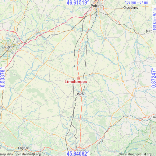
Limalonges GPS coordinates[2]
46° 7' 48.216" North, 0° 10' 9.624" East
| Map corner | latitude | longitude |
|---|---|---|
| Upper-left | 46.61519°, | -0.53378° |
| Center: | 46.13006°, | 0.16934° |
| Lower-right: | 45.64062°, | 0.87247° |
| Map W x H: | 108.4×108.4 km | = 67.4×67.4mi |
| max Lat: | 51.07786° ⇑64.6% North |
| Limalonges: | 46.13006° |
| min Lat: | ⇓35.4% South 41.3874° |
| min Long | Limalonges | max Long |
| -5.08615° | 0.16934° | 9.52242° |
| W 23.5%⇐ | ⇒76.5% E |
Elevation
Elevation of Limalonges is 128 m = 420 ft, and this is 65.7 m = 216 ft below average elevation for this country.
| Max E: |
2333 m = 7654 ft | 51.2% |
| Avg. | 193.7 m = 635 ft | |
| Limalonges | 128 m = 420 ft | |
Min E: |
-1 m = -3 ft | 48.8% |
See also: France elevation on elevation.city.
Geographical zone
Limalonges is located in North temperate zone (between Tropic of Cancer and the Arctic Circle). Distance of this North polar circle is 2272 km =1411.8 mi to North.| Distance of | km | miles | from Limalonges |
|---|---|---|---|
| North Pole | 4877.9 | 3031 | to North |
| Arctic Circle | 2272 | 1411.8 | to North |
| Tropic Cancer | 2523.3 | 1567.9 | to South |
| Equator | 5129.2 | 3187.1 | to South |


Nearby cities:
15 places around Limalonges: (largest is in red/bold)
• Blanzay
10.4 km =6.5 mi,  39°
39°
• Brux
11.9 km =7.4 mi,  8°
8°
• Chaunay
8.6 km =5.3 mi,  357°
357°
• Civray
9.9 km =6.2 mi,  78°
78°
• Clussais
11.9 km =7.4 mi,  308°
308°
• Genouillé
13.2 km =8.2 mi,  100°
100°
• Gournay-Loizé
17 km =10.6 mi,  277°
277°
• La Faye
12.4 km =7.7 mi,  188°
188°
• Melleran
12.9 km =8 mi,  270°
270°
• Ruffec
11.5 km =7.1 mi,  168°
168°
• Sauzé-Vaussais
4.8 km =3 mi, 274°
• Savigné
12.1 km =7.5 mi,  74°
74°
• Taizé-Aizie
8.8 km =5.5 mi,  144°
144°
• Verteuil-sur-Charente
17.2 km =10.7 mi,  163°
163°
• Villefagnan
14.9 km =9.3 mi,  207°
207°
Sources, notices
• [Note1] Compared only with cities in France existing in our database
• [Src1] Map data: © OpenStreetMap contributors (CC-BY-SA)
• [Src2] Other city data from geonames.org with taken over terms of usage.
• [Src3] Geographical zone / Annual Mean Temperature by Robert A. Rohde @ Wikipedia
