Brindas geodata
Brindas (Auvergne-Rhône-Alpes) is a populated place; located in France in Europe/Paris (GMT+2) time zone. With population of 4,859 people, there are 2043 cities with bigger population in this country. Compared to other cities in France, 70.5% of cities are located further ↑North; 73.7% of cities are located further ←West and 79.9% of cities have lower elevation than Brindas. Note1
Administrative division(s):
- Level 1: Auvergne-Rhône-Alpes
- Level 2: Département du Rhône
- Level 3: Arrondissement de Lyon
- Level 4: Brindas


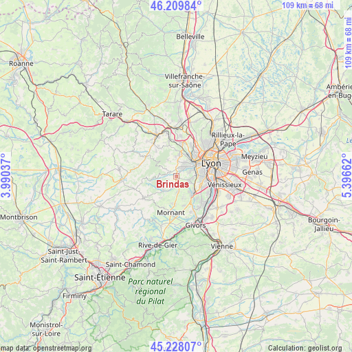
Brindas GPS coordinates[2]
45° 43' 15.996" North, 4° 41' 36.564" East
| Map corner | latitude | longitude |
|---|---|---|
| Upper-left | 46.20984°, | 3.99037° |
| Center: | 45.72111°, | 4.69349° |
| Lower-right: | 45.22807°, | 5.39662° |
| Map W x H: | 109.2×109.2 km | = 67.9×67.9mi |
| max Lat: | 51.07786° ⇑70.5% North |
| Brindas: | 45.72111° |
| min Lat: | ⇓29.5% South 41.3874° |
| min Long | Brindas | max Long |
| -5.08615° | 4.69349° | 9.52242° |
| W 73.7%⇐ | ⇒26.3% E |
Elevation
Elevation of Brindas is 289 m = 948 ft, and this is 95.3 m = 313 ft above average elevation for this country.
| Max E: |
2333 m = 7654 ft | 20.1% |
| Brindas | 289 m 948 ft | |
| Avg. | 193.7 m = 635 ft | |
Min E: |
-1 m = -3 ft | 79.9% |
See also: France elevation on elevation.city.
Geographical zone
Brindas is located in North temperate zone (between Tropic of Cancer and the Arctic Circle). Distance of this North polar circle is 2317.5 km =1440 mi to North.| Distance of | km | miles | from Brindas |
|---|---|---|---|
| North Pole | 4923.4 | 3059.3 | to North |
| Arctic Circle | 2317.5 | 1440 | to North |
| Tropic Cancer | 2477.8 | 1539.6 | to South |
| Equator | 5083.7 | 3158.9 | to South |


Nearby cities:
15 places around Brindas: (largest is in red/bold)
• Brignais
7.1 km =4.4 mi,  138°
138°
• Chaponost
4 km =2.5 mi,  107°
107°
• Charbonnières-les-Bains
7.8 km =4.8 mi,  31°
31°
• Craponne
3.5 km =2.2 mi,  40°
40°
• Francheville
5.7 km =3.5 mi,  72°
72°
• Grézieu-la-Varenne
2.9 km =1.8 mi,  355°
355°
• Messimy
3 km =1.9 mi,  210°
210°
• Orliénas
7.2 km =4.5 mi,  164°
164°
• Pollionnay
5.4 km =3.4 mi,  332°
332°
• Saint-Genis-Laval
8.2 km =5.1 mi, 110°
• Saint-Genis-les-Ollières
4.7 km =2.9 mi, 32°
• Sainte-Consorce
6.1 km =3.8 mi, 357°
• Soucieu-en-Jarrest
4.9 km =3 mi,  170°
170°
• Thurins
6 km =3.7 mi,  223°
223°
• Vaugneray
3.4 km =2.1 mi,  303°
303°
Sources, notices
• [Note1] Compared only with cities in France existing in our database
• [Src1] Map data: © OpenStreetMap contributors (CC-BY-SA)
• [Src2] Other city data from geonames.org with taken over terms of usage.
• [Src3] Geographical zone / Annual Mean Temperature by Robert A. Rohde @ Wikipedia
