Saint-Genis-les-Ollières geodata
Saint-Genis-les-Ollières (Auvergne-Rhône-Alpes) is a populated place; located in France in Europe/Paris (GMT+2) time zone. With population of 5,029 people, there are 1966 cities with bigger population in this country. Compared to other cities in France, 69.9% of cities are located further ↑North; 74.1% of cities are located further ←West and 75.8% of cities have lower elevation than Saint-Genis-les-Ollières. Note1
Administrative division(s):
- Level 1: Auvergne-Rhône-Alpes
- Level 2: Département du Rhône
- Level 3: Arrondissement de Lyon
- Level 4: Saint-Genis-les-Ollières
Current local time in Saint-Genis-les-Ollières:
05:57 AM, WednesdayDifference from your time zone: hours


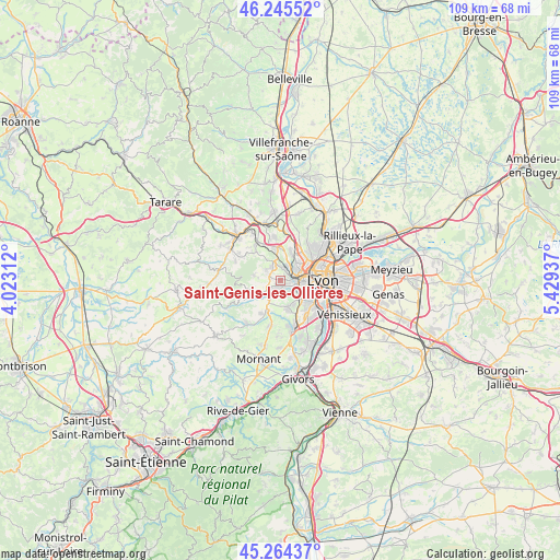
Saint-Genis-les-Ollières GPS coordinates[2]
45° 45' 25.56" North, 4° 43' 34.5" East
| Map corner | latitude | longitude |
|---|---|---|
| Upper-left | 46.24552°, | 4.02312° |
| Center: | 45.7571°, | 4.72625° |
| Lower-right: | 45.26437°, | 5.42937° |
| Map W x H: | 109.1×109.1 km | = 67.8×67.8mi |
| max Lat: | 51.07786° ⇑69.9% North |
| Saint-Genis-les-Ollières: | 45.7571° |
| min Lat: | ⇓30.1% South 41.3874° |
| min Long | Saint-Genis-les | max Long |
| -5.08615° | 4.72625° | 9.52242° |
| W 74.1%⇐ | ⇒25.9% E |
Elevation
Elevation of Saint-Genis-les-Ollières is 255 m = 837 ft, and this is 61.3 m = 201 ft above average elevation for this country.
| Max E: |
2333 m = 7654 ft | 24.2% |
| Saint-Genis-les-Ollières | 255 m 837 ft | |
| Avg. | 193.7 m = 635 ft | |
Min E: |
-1 m = -3 ft | 75.8% |
See also: France elevation on elevation.city.
Geographical zone
Saint-Genis-les-Ollières is located in North temperate zone (between Tropic of Cancer and the Arctic Circle). Distance of this North polar circle is 2313.5 km =1437.5 mi to North.| Distance of | km | miles | from Saint-Genis-les-Ollières |
|---|---|---|---|
| North Pole | 4919.3 | 3056.7 | to North |
| Arctic Circle | 2313.5 | 1437.5 | to North |
| Tropic Cancer | 2481.8 | 1542.1 | to South |
| Equator | 5087.7 | 3161.3 | to South |


Nearby cities:
15 places around Saint-Genis-les-Ollières: (largest is in red/bold)
• Brindas
4.7 km =2.9 mi,  212°
212°
• Champagne-au-Mont-d’Or
6.5 km =4 mi,  50°
50°
• Chaponost
5.4 km =3.4 mi,  166°
166°
• Charbonnières-les-Bains
3 km =1.9 mi,  30°
30°
• Craponne
1.3 km =0.8 mi,  190°
190°
• Dardilly
5.8 km =3.6 mi,  21°
21°
• Francheville
3.7 km =2.3 mi,  128°
128°
• Grézieu-la-Varenne
3 km =1.9 mi,  248°
248°
• La Tour-de-Salvagny
6.3 km =3.9 mi,  353°
353°
• Pollionnay
5.1 km =3.2 mi,  279°
279°
• Sainte-Consorce
3.5 km =2.2 mi,  306°
306°
• Sainte-Foy-lès-Lyon
6.5 km =4 mi,  113°
113°
• Tassin-la-Demi-Lune
4.8 km =3 mi,  92°
92°
• Vaugneray
5.8 km =3.6 mi, 248°
• Écully
4.4 km =2.7 mi,  64°
64°
Sources, notices
• [Note1] Compared only with cities in France existing in our database
• [Src1] Map data: © OpenStreetMap contributors (CC-BY-SA)
• [Src2] Other city data from geonames.org with taken over terms of usage.
• [Src3] Geographical zone / Annual Mean Temperature by Robert A. Rohde @ Wikipedia
