Cronat geodata
Cronat (Bourgogne-Franche-Comté) is a populated place; located in France in Europe/Paris (GMT+2) time zone. With population of 563 people, there are 13957 cities with bigger population in this country. Compared to other cities in France, 58% of cities are located further ↑North; 65.6% of cities are located further ←West and 72% of cities have lower elevation than Cronat. Note1
Administrative division(s):
- Level 1: Bourgogne-Franche-Comté
- Level 2: Département de Saône-et-Loire
- Level 3: Arrondissement de Charolles
- Level 4: Cronat


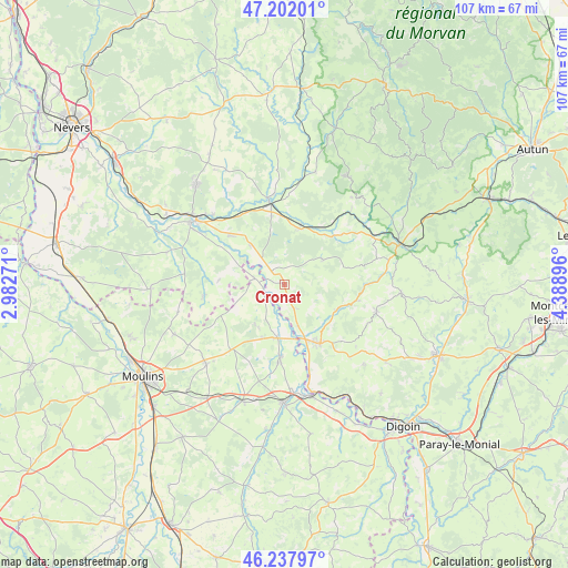
Cronat GPS coordinates[2]
46° 43' 19.704" North, 3° 41' 8.988" East
| Map corner | latitude | longitude |
|---|---|---|
| Upper-left | 47.20201°, | 2.98271° |
| Center: | 46.72214°, | 3.68583° |
| Lower-right: | 46.23797°, | 4.38896° |
| Map W x H: | 107.2×107.2 km | = 66.6×66.6mi |
| max Lat: | 51.07786° ⇑58% North |
| Cronat: | 46.72214° |
| min Lat: | ⇓42% South 41.3874° |
| min Long | Cronat | max Long |
| -5.08615° | 3.68583° | 9.52242° |
| W 65.6%⇐ | ⇒34.4% E |
Elevation
Elevation of Cronat is 230 m = 755 ft, and this is 36.3 m = 119 ft above average elevation for this country.
| Max E: |
2333 m = 7654 ft | 28% |
| Cronat | 230 m 755 ft | |
| Avg. | 193.7 m = 635 ft | |
Min E: |
-1 m = -3 ft | 72% |
See also: France elevation on elevation.city.
Geographical zone
Cronat is located in North temperate zone (between Tropic of Cancer and the Arctic Circle). Distance of this North polar circle is 2206.2 km =1370.9 mi to North.| Distance of | km | miles | from Cronat |
|---|---|---|---|
| North Pole | 4812 | 2990 | to North |
| Arctic Circle | 2206.2 | 1370.9 | to North |
| Tropic Cancer | 2589.1 | 1608.8 | to South |
| Equator | 5195 | 3228 | to South |


Nearby cities:
15 places around Cronat: (largest is in red/bold)
• Beaulon
13.4 km =8.3 mi,  184°
184°
• Bourbon-Lancy
12.8 km =8 mi,  150°
150°
• Cercy-la-Tour
15.8 km =9.8 mi,  349°
349°
• Chalmoux
18.4 km =11.4 mi,  137°
137°
• Champvert
18.8 km =11.7 mi,  314°
314°
• Charrin
9.9 km =6.2 mi,  317°
317°
• Chevagnes
16.1 km =10 mi,  219°
219°
• Cossaye
15.6 km =9.7 mi,  280°
280°
• Decize
20.8 km =12.9 mi,  304°
304°
• Fours
10.9 km =6.8 mi,  14°
14°
• Garnat-sur-Engièvre
10 km =6.2 mi,  190°
190°
• Grury
17.9 km =11.1 mi,  106°
106°
• Lucenay-lès-Aix
15.6 km =9.7 mi,  262°
262°
• Lusigny
21.1 km =13.1 mi, 224°
• Saint-Ennemond
20.7 km =12.9 mi, 255°
Sources, notices
• [Note1] Compared only with cities in France existing in our database
• [Src1] Map data: © OpenStreetMap contributors (CC-BY-SA)
• [Src2] Other city data from geonames.org with taken over terms of usage.
• [Src3] Geographical zone / Annual Mean Temperature by Robert A. Rohde @ Wikipedia
