Ville-d’Avray geodata
Ville-d’Avray (Île-de-France) is a populated place; located in France in Europe/Paris (GMT+2) time zone. With population of 11,431 people, there are 843 cities with bigger population in this country. Compared to other cities in France, 76.1% of cities are located further ↓South; 54.5% of cities are located further →East and 55.6% of cities have higher elevation than Ville-d’Avray. Note1
Administrative division(s):
- Level 1: Île-de-France
- Level 2: Hauts-de-Seine
- Level 3: Arrondissement de Boulogne-Billancourt
- Level 4: Ville-d'Avray


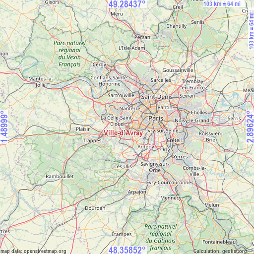
Ville-d’Avray GPS coordinates[2]
48° 49' 24.888" North, 2° 11' 35.196" East
| Map corner | latitude | longitude |
|---|---|---|
| Upper-left | 49.28437°, | 1.48999° |
| Center: | 48.82358°, | 2.19311° |
| Lower-right: | 48.35852°, | 2.89624° |
| Map W x H: | 102.9×102.9 km | = 63.9×63.9mi |
| max Lat: | 51.07786° ⇑23.9% North |
| Ville-d’Avray: | 48.82358° |
| min Lat: | ⇓76.1% South 41.3874° |
| min Long | Ville-d’Avray | max Long |
| -5.08615° | 2.19311° | 9.52242° |
| W 45.5%⇐ | ⇒54.5% E |
Elevation
Elevation of Ville-d’Avray is 115 m = 377 ft, and this is 78.7 m = 258 ft below average elevation for this country.
| Max E: |
2333 m = 7654 ft | 55.6% |
| Avg. | 193.7 m = 635 ft | |
| Ville-d’Avray | 115 m = 377 ft | |
Min E: |
-1 m = -3 ft | 44.4% |
See also: France elevation on elevation.city.
Geographical zone
Ville-d’Avray is located in North temperate zone (between Tropic of Cancer and the Arctic Circle). Distance of this North polar circle is 1972.5 km =1225.7 mi to North.| Distance of | km | miles | from Ville-d’Avray |
|---|---|---|---|
| North Pole | 4578.4 | 2844.9 | to North |
| Arctic Circle | 1972.5 | 1225.7 | to North |
| Tropic Cancer | 2822.8 | 1754 | to South |
| Equator | 5428.7 | 3373.2 | to South |


Nearby cities:
15 places around Ville-d’Avray: (largest is in red/bold)
• Bougival
5.7 km =3.5 mi,  318°
318°
• Boulogne-Billancourt
3.8 km =2.4 mi,  69°
69°
• Chaville
2 km =1.2 mi,  189°
189°
• Garches
2.2 km =1.4 mi,  339°
339°
• La Celle-Saint-Cloud
4.6 km =2.9 mi,  310°
310°
• Le Chesnay
5.2 km =3.2 mi,  268°
268°
• Marnes-la-Coquette
1.6 km =1 mi,  284°
284°
• Meudon
3.3 km =2.1 mi,  109°
109°
• Saint-Cloud
2.6 km =1.6 mi,  16°
16°
• Suresnes
5.9 km =3.7 mi,  26°
26°
• Sèvres
1.8 km =1.1 mi,  92°
92°
• Vaucresson
3.3 km =2.1 mi, 305°
• Versailles
4.8 km =3 mi,  242°
242°
• Viroflay
3.4 km =2.1 mi,  222°
222°
• Vélizy-Villacoublay
4.6 km =2.9 mi,  179°
179°
Sources, notices
• [Note1] Compared only with cities in France existing in our database
• [Src1] Map data: © OpenStreetMap contributors (CC-BY-SA)
• [Src2] Other city data from geonames.org with taken over terms of usage.
• [Src3] Geographical zone / Annual Mean Temperature by Robert A. Rohde @ Wikipedia
