Boulleret geodata
Boulleret (Centre) is a populated place; located in France in Europe/Paris (GMT+2) time zone. With population of 1,420 people, there are 6522 cities with bigger population in this country. Compared to other cities in France, 50.2% of cities are located further ↓South; 56.1% of cities are located further ←West and 60% of cities have lower elevation than Boulleret. Note1
Administrative division(s):
- Level 1: Centre
- Level 2: Cher
- Level 3: Arrondissement de Bourges
- Level 4: Boulleret


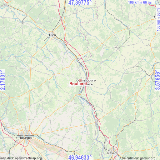
Boulleret GPS coordinates[2]
47° 25' 27.084" North, 2° 52' 24.348" East
| Map corner | latitude | longitude |
|---|---|---|
| Upper-left | 47.89775°, | 2.17031° |
| Center: | 47.42419°, | 2.87343° |
| Lower-right: | 46.94633°, | 3.57656° |
| Map W x H: | 105.8×105.8 km | = 65.7×65.7mi |
| max Lat: | 51.07786° ⇑49.8% North |
| Boulleret: | 47.42419° |
| min Lat: | ⇓50.2% South 41.3874° |
| min Long | Boulleret | max Long |
| -5.08615° | 2.87343° | 9.52242° |
| W 56.1%⇐ | ⇒43.9% E |
Elevation
Elevation of Boulleret is 170 m = 558 ft, and this is 23.7 m = 78 ft below average elevation for this country.
| Max E: |
2333 m = 7654 ft | 40% |
| Avg. | 193.7 m = 635 ft | |
| Boulleret | 170 m = 558 ft | |
Min E: |
-1 m = -3 ft | 60% |
See also: France elevation on elevation.city.
Geographical zone
Boulleret is located in North temperate zone (between Tropic of Cancer and the Arctic Circle). Distance of this North polar circle is 2128.1 km =1322.3 mi to North.| Distance of | km | miles | from Boulleret |
|---|---|---|---|
| North Pole | 4734 | 2941.6 | to North |
| Arctic Circle | 2128.1 | 1322.3 | to North |
| Tropic Cancer | 2667.2 | 1657.3 | to South |
| Equator | 5273.1 | 3276.6 | to South |


Nearby cities:
15 places around Boulleret: (largest is in red/bold)
• Alligny-Cosne
14.4 km =8.9 mi,  76°
76°
• Bannay
4.1 km =2.5 mi,  169°
169°
• Belleville-sur-Loire
8.6 km =5.3 mi,  348°
348°
• Cosne-Cours-sur-Loire
4.2 km =2.6 mi,  110°
110°
• La Celle-sur-Loire
6.8 km =4.2 mi,  38°
38°
• Léré
5 km =3.1 mi,  356°
356°
• Myennes
5.1 km =3.2 mi,  61°
61°
• Neuvy-sur-Loire
11 km =6.8 mi,  3°
3°
• Saint-Andelain
14.4 km =8.9 mi,  152°
152°
• Saint-Satur
9.8 km =6.1 mi,  196°
196°
• Sancerre
11 km =6.8 mi, 195°
• Savigny-en-Sancerre
5.2 km =3.2 mi,  291°
291°
• Sury-en-Vaux
8.1 km =5 mi,  219°
219°
• Sury-près-Léré
6.7 km =4.2 mi, 356°
• Tracy-sur-Loire
11.6 km =7.2 mi, 174°
Sources, notices
• [Note1] Compared only with cities in France existing in our database
• [Src1] Map data: © OpenStreetMap contributors (CC-BY-SA)
• [Src2] Other city data from geonames.org with taken over terms of usage.
• [Src3] Geographical zone / Annual Mean Temperature by Robert A. Rohde @ Wikipedia
