Boulbon geodata
Boulbon (Provence-Alpes-Côte d'Azur) is a populated place; located in France in Europe/Paris (GMT+2) time zone. With population of 1,587 people, there are 5882 cities with bigger population in this country. Compared to other cities in France, 88.5% of cities are located further ↑North; 73.7% of cities are located further ←West and 92.4% of cities have higher elevation than Boulbon. Note1
Administrative division(s):
- Level 1: Provence-Alpes-Côte d'Azur
- Level 2: Département des Bouches-du-Rhône
- Level 3: Arles
- Level 4: Boulbon


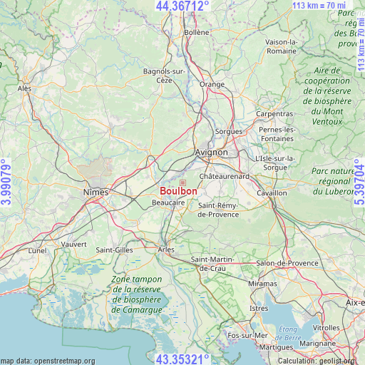
Boulbon GPS coordinates[2]
43° 51' 44.352" North, 4° 41' 38.076" East
| Map corner | latitude | longitude |
|---|---|---|
| Upper-left | 44.36712°, | 3.99079° |
| Center: | 43.86232°, | 4.69391° |
| Lower-right: | 43.35321°, | 5.39704° |
| Map W x H: | 112.7×112.7 km | = 70×70mi |
| max Lat: | 51.07786° ⇑88.5% North |
| Boulbon: | 43.86232° |
| min Lat: | ⇓11.5% South 41.3874° |
| min Long | Boulbon | max Long |
| -5.08615° | 4.69391° | 9.52242° |
| W 73.7%⇐ | ⇒26.3% E |
Elevation
Elevation of Boulbon is 24 m = 79 ft, and this is 169.7 m = 557 ft below average elevation for this country.
| Max E: |
2333 m = 7654 ft | 92.4% |
| Avg. | 193.7 m = 635 ft | |
| Boulbon | 24 m = 79 ft | |
Min E: |
-1 m = -3 ft | 7.6% |
See also: France elevation on elevation.city.
Geographical zone
Boulbon is located in North temperate zone (between Tropic of Cancer and the Arctic Circle). Distance of this Northern Tropic circle is 2271.1 km =1411.2 mi to South.| Distance of | km | miles | from Boulbon |
|---|---|---|---|
| North Pole | 5130 | 3187.6 | to North |
| Arctic Circle | 2524.1 | 1568.4 | to North |
| Tropic Cancer | 2271.1 | 1411.2 | to South |
| Equator | 4877 | 3030.4 | to South |


Nearby cities:
15 places around Boulbon: (largest is in red/bold)
• Aramon
3.4 km =2.1 mi,  342°
342°
• Barbentane
6 km =3.7 mi,  46°
46°
• Beaucaire
7.2 km =4.5 mi,  213°
213°
• Comps
7.1 km =4.4 mi,  261°
261°
• Domazan
8.2 km =5.1 mi,  334°
334°
• Fournès
10 km =6.2 mi,  313°
313°
• Graveson
6.5 km =4 mi,  101°
101°
• Maillane
7.8 km =4.8 mi,  114°
114°
• Montfrin
7.7 km =4.8 mi,  281°
281°
• Rognonas
9.7 km =6 mi,  64°
64°
• Saint-Étienne-du-Grès
9.4 km =5.8 mi,  164°
164°
• Saze
9.1 km =5.7 mi,  353°
353°
• Tarascon
6.8 km =4.2 mi,  203°
203°
• Théziers
7.1 km =4.4 mi, 305°
• Vallabrègues
5.5 km =3.4 mi, 259°
Sources, notices
• [Note1] Compared only with cities in France existing in our database
• [Src1] Map data: © OpenStreetMap contributors (CC-BY-SA)
• [Src2] Other city data from geonames.org with taken over terms of usage.
• [Src3] Geographical zone / Annual Mean Temperature by Robert A. Rohde @ Wikipedia
