Saze geodata
Saze (Occitanie) is a populated place; located in France in Europe/Paris (GMT+2) time zone. With population of 1,590 people, there are 5868 cities with bigger population in this country. Compared to other cities in France, 87.6% of cities are located further ↑North; 73.5% of cities are located further ←West and 67% of cities have higher elevation than Saze. Note1
Administrative division(s):
- Level 1: Occitanie
- Level 2: Gard
- Level 3: Arrondissement de Nîmes
- Level 4: Saze


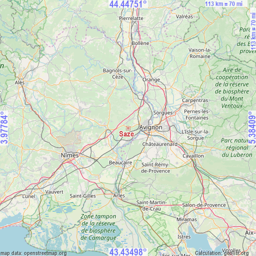
Saze GPS coordinates[2]
43° 56' 36.24" North, 4° 40' 51.456" East
| Map corner | latitude | longitude |
|---|---|---|
| Upper-left | 44.44751°, | 3.97784° |
| Center: | 43.9434°, | 4.68096° |
| Lower-right: | 43.43498°, | 5.38409° |
| Map W x H: | 112.6×112.6 km | = 70×70mi |
| max Lat: | 51.07786° ⇑87.6% North |
| Saze: | 43.9434° |
| min Lat: | ⇓12.4% South 41.3874° |
| min Long | Saze | max Long |
| -5.08615° | 4.68096° | 9.52242° |
| W 73.5%⇐ | ⇒26.5% E |
Elevation
Elevation of Saze is 85 m = 279 ft, and this is 108.7 m = 357 ft below average elevation for this country.
| Max E: |
2333 m = 7654 ft | 67% |
| Avg. | 193.7 m = 635 ft | |
| Saze | 85 m = 279 ft | |
Min E: |
-1 m = -3 ft | 33% |
See also: France elevation on elevation.city.
Geographical zone
Saze is located in North temperate zone (between Tropic of Cancer and the Arctic Circle). Distance of this Northern Tropic circle is 2280.1 km =1416.8 mi to South.| Distance of | km | miles | from Saze |
|---|---|---|---|
| North Pole | 5121 | 3182 | to North |
| Arctic Circle | 2515.1 | 1562.8 | to North |
| Tropic Cancer | 2280.1 | 1416.8 | to South |
| Equator | 4886 | 3036 | to South |


Nearby cities:
15 places around Saze: (largest is in red/bold)
• Aramon
5.7 km =3.5 mi,  180°
180°
• Avignon
10.3 km =6.4 mi,  86°
86°
• Barbentane
7.2 km =4.5 mi,  132°
132°
• Boulbon
9.1 km =5.7 mi,  173°
173°
• Domazan
2.9 km =1.8 mi,  236°
236°
• Fournès
6.6 km =4.1 mi,  251°
251°
• Les Angles
6.8 km =4.2 mi,  76°
76°
• Lirac
10.3 km =6.4 mi,  2°
2°
• Montfrin
9.9 km =6.2 mi,  220°
220°
• Pujaut
10.1 km =6.3 mi,  48°
48°
• Remoulins
9.1 km =5.7 mi,  267°
267°
• Rochefort-du-Gard
3.8 km =2.4 mi,  11°
11°
• Tavel
7.8 km =4.8 mi, 10°
• Théziers
6.8 km =4.2 mi, 224°
• Villeneuve-lès-Avignon
9.6 km =6 mi,  73°
73°
Sources, notices
• [Note1] Compared only with cities in France existing in our database
• [Src1] Map data: © OpenStreetMap contributors (CC-BY-SA)
• [Src2] Other city data from geonames.org with taken over terms of usage.
• [Src3] Geographical zone / Annual Mean Temperature by Robert A. Rohde @ Wikipedia
