Berjou geodata
Berjou (Normandy) is a populated place; located in France in Europe/Paris (GMT+2) time zone. With population of 515 people, there are 14927 cities with bigger population in this country. Compared to other cities in France, 76.6% of cities are located further ↓South; 83.1% of cities are located further →East and 68% of cities have lower elevation than Berjou. Note1
Administrative division(s):
- Level 1: Normandy
- Level 2: Département de l'Orne
- Level 3: Argentan
- Level 4: Berjou


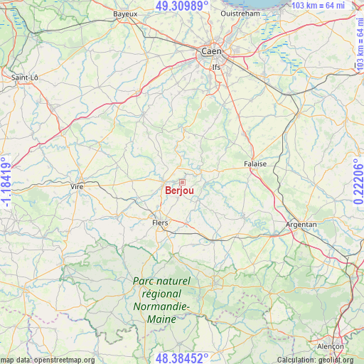
Berjou GPS coordinates[2]
48° 50' 57.624" North, 0° 28' 51.816" West
| Map corner | latitude | longitude |
|---|---|---|
| Upper-left | 49.30989°, | -1.18419° |
| Center: | 48.84934°, | -0.48106° |
| Lower-right: | 48.38452°, | 0.22206° |
| Map W x H: | 102.9×102.9 km | = 63.9×63.9mi |
| max Lat: | 51.07786° ⇑23.4% North |
| Berjou: | 48.84934° |
| min Lat: | ⇓76.6% South 41.3874° |
| min Long | Berjou | max Long |
| -5.08615° | -0.48106° | 9.52242° |
| W 16.9%⇐ | ⇒83.1% E |
Elevation
Elevation of Berjou is 209 m = 686 ft, and this is 15.3 m = 50 ft above average elevation for this country.
| Max E: |
2333 m = 7654 ft | 32% |
| Berjou | 209 m 686 ft | |
| Avg. | 193.7 m = 635 ft | |
Min E: |
-1 m = -3 ft | 68% |
See also: France elevation on elevation.city.
Geographical zone
Berjou is located in North temperate zone (between Tropic of Cancer and the Arctic Circle). Distance of this North polar circle is 1969.6 km =1223.9 mi to North.| Distance of | km | miles | from Berjou |
|---|---|---|---|
| North Pole | 4575.5 | 2843.1 | to North |
| Arctic Circle | 1969.6 | 1223.9 | to North |
| Tropic Cancer | 2825.6 | 1755.7 | to South |
| Equator | 5431.5 | 3375 | to South |


Nearby cities:
15 places around Berjou: (largest is in red/bold)
• Athis-de-l'Orne
3.9 km =2.4 mi,  200°
200°
• Caligny
9.5 km =5.9 mi,  241°
241°
• Clécy
7.5 km =4.7 mi,  0°
0°
• Condé-sur-Noireau
5.2 km =3.2 mi,  269°
269°
• Flers
14.2 km =8.8 mi,  208°
208°
• La Lande-Patry
13 km =8.1 mi,  221°
221°
• La Selle-la-Forge
13.7 km =8.5 mi, 198°
• Montilly-sur-Noireau
7.6 km =4.7 mi, 239°
• Pont-d'Ouilly
6.5 km =4 mi,  62°
62°
• Saint-Denis-de-Méré
3.5 km =2.2 mi,  310°
310°
• Saint-Georges-des-Groseillers
10.9 km =6.8 mi, 215°
• Saint-Germain-du-Crioult
9.1 km =5.7 mi, 274°
• Saint-Pierre-du-Regard
4.8 km =3 mi,  261°
261°
• Saint-Rémy
10.2 km =6.3 mi,  350°
350°
• Sainte-Honorine-la-Chardonne
2.8 km =1.7 mi,  187°
187°
Sources, notices
• [Note1] Compared only with cities in France existing in our database
• [Src1] Map data: © OpenStreetMap contributors (CC-BY-SA)
• [Src2] Other city data from geonames.org with taken over terms of usage.
• [Src3] Geographical zone / Annual Mean Temperature by Robert A. Rohde @ Wikipedia
