Athis-de-l'Orne geodata
Athis-de-l'Orne (Normandy) is a populated place; located in France in Europe/Paris (GMT+2) time zone. With population of 2,605 people, there are 3746 cities with bigger population in this country. Compared to other cities in France, 75.9% of cities are located further ↓South; 83.4% of cities are located further →East and 71.4% of cities have lower elevation than Athis-de-l'Orne. Note1
Administrative division(s):
- Level 1: Normandy
- Level 2: Département de l'Orne
- Level 3: Argentan
- Level 4: Athis-Val de Rouvre


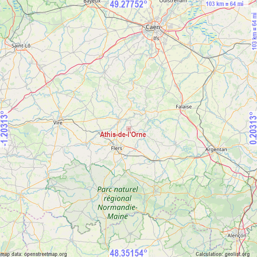
Athis-de-l'Orne GPS coordinates[2]
48° 49' 0.012" North, 0° 30' 0" West
| Map corner | latitude | longitude |
|---|---|---|
| Upper-left | 49.27752°, | -1.20313° |
| Center: | 48.81667°, | -0.5° |
| Lower-right: | 48.35154°, | 0.20313° |
| Map W x H: | 103×103 km | = 64×64mi |
| max Lat: | 51.07786° ⇑24.1% North |
| Athis-de-l'Orne: | 48.81667° |
| min Lat: | ⇓75.9% South 41.3874° |
| min Long | Athis-de-l'Orne | max Long |
| -5.08615° | -0.5° | 9.52242° |
| W 16.6%⇐ | ⇒83.4% E |
Elevation
Elevation of Athis-de-l'Orne is 226 m = 741 ft, and this is 32.3 m = 106 ft above average elevation for this country.
| Max E: |
2333 m = 7654 ft | 28.6% |
| Athis-de-l'Orne | 226 m 741 ft | |
| Avg. | 193.7 m = 635 ft | |
Min E: |
-1 m = -3 ft | 71.4% |
See also: France elevation on elevation.city.
Geographical zone
Athis-de-l'Orne is located in North temperate zone (between Tropic of Cancer and the Arctic Circle). Distance of this North polar circle is 1973.3 km =1226.2 mi to North.| Distance of | km | miles | from Athis-de-l'Orne |
|---|---|---|---|
| North Pole | 4579.2 | 2845.4 | to North |
| Arctic Circle | 1973.3 | 1226.2 | to North |
| Tropic Cancer | 2822 | 1753.5 | to South |
| Equator | 5427.9 | 3372.7 | to South |


Nearby cities:
15 places around Athis-de-l'Orne: (largest is in red/bold)
• Berjou
3.9 km =2.4 mi,  20°
20°
• Caligny
7 km =4.3 mi,  262°
262°
• Clécy
11.3 km =7 mi,  7°
7°
• Condé-sur-Noireau
5.2 km =3.2 mi,  313°
313°
• Flers
10.4 km =6.5 mi,  211°
211°
• La Lande-Patry
9.4 km =5.8 mi,  229°
229°
• La Selle-la-Forge
9.8 km =6.1 mi,  197°
197°
• Messei
12 km =7.5 mi,  193°
193°
• Montilly-sur-Noireau
5.2 km =3.2 mi,  267°
267°
• Pont-d'Ouilly
9.7 km =6 mi,  47°
47°
• Saint-Denis-de-Méré
6 km =3.7 mi,  347°
347°
• Saint-Georges-des-Groseillers
7.2 km =4.5 mi,  223°
223°
• Saint-Germain-du-Crioult
8.8 km =5.5 mi,  300°
300°
• Saint-Pierre-du-Regard
4.5 km =2.8 mi, 310°
• Sainte-Honorine-la-Chardonne
1.4 km =0.9 mi, 50°
Sources, notices
• [Note1] Compared only with cities in France existing in our database
• [Src1] Map data: © OpenStreetMap contributors (CC-BY-SA)
• [Src2] Other city data from geonames.org with taken over terms of usage.
• [Src3] Geographical zone / Annual Mean Temperature by Robert A. Rohde @ Wikipedia
