Belmont-sur-Rance geodata
Belmont-sur-Rance (Occitanie) is a populated place; located in France in Europe/Paris (GMT+2) time zone. With population of 1,041 people, there are 8531 cities with bigger population in this country. Compared to other cities in France, 88.9% of cities are located further ↑North; 54.3% of cities are located further ←West and 92.3% of cities have lower elevation than Belmont-sur-Rance. Note1
Administrative division(s):
- Level 1: Occitanie
- Level 2: Département de l'Aveyron
- Level 3: Arrondissement de Millau
- Level 4: Belmont-sur-Rance


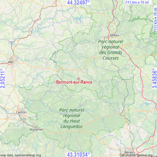
Belmont-sur-Rance GPS coordinates[2]
43° 49' 11.316" North, 2° 45' 18.864" East
| Map corner | latitude | longitude |
|---|---|---|
| Upper-left | 44.32497°, | 2.05211° |
| Center: | 43.81981°, | 2.75524° |
| Lower-right: | 43.31034°, | 3.45836° |
| Map W x H: | 112.8×112.8 km | = 70.1×70.1mi |
| max Lat: | 51.07786° ⇑88.9% North |
| Belmont-sur-Rance: | 43.81981° |
| min Lat: | ⇓11.1% South 41.3874° |
| min Long | Belmont-sur-Ran | max Long |
| -5.08615° | 2.75524° | 9.52242° |
| W 54.3%⇐ | ⇒45.7% E |
Elevation
Elevation of Belmont-sur-Rance is 482 m = 1581 ft, and this is 288.3 m = 946 ft above average elevation for this country.
| Max E: |
2333 m = 7654 ft | 7.7% |
| Belmont-sur-Rance | 482 m 1581 ft | |
| Avg. | 193.7 m = 635 ft | |
Min E: |
-1 m = -3 ft | 92.3% |
See also: France elevation on elevation.city.
Geographical zone
Belmont-sur-Rance is located in North temperate zone (between Tropic of Cancer and the Arctic Circle). Distance of this Northern Tropic circle is 2266.4 km =1408.3 mi to South.| Distance of | km | miles | from Belmont-sur-Rance |
|---|---|---|---|
| North Pole | 5134.8 | 3190.6 | to North |
| Arctic Circle | 2528.9 | 1571.4 | to North |
| Tropic Cancer | 2266.4 | 1408.3 | to South |
| Equator | 4872.3 | 3027.5 | to South |


Nearby cities:
15 places around Belmont-sur-Rance: (largest is in red/bold)
• Alban
24.8 km =15.4 mi,  287°
287°
• Broquiès
21.1 km =13.1 mi,  347°
347°
• Camarès
10 km =6.2 mi,  88°
88°
• Coupiac
20.3 km =12.6 mi,  317°
317°
• Curvalle
20.6 km =12.8 mi,  305°
305°
• La Salvetat-sur-Agout
24.6 km =15.3 mi,  187°
187°
• Lacaune
13.5 km =8.4 mi,  201°
201°
• Montlaur
9.2 km =5.7 mi,  42°
42°
• Murat-sur-Vèbre
17 km =10.6 mi,  151°
151°
• Paulinet
26.2 km =16.3 mi,  277°
277°
• Roquefort-sur-Soulzon
25.6 km =15.9 mi,  47°
47°
• Saint-Affrique
18.5 km =11.5 mi, 35°
• Saint-Pierre-de-Trivisy
26.6 km =16.5 mi,  255°
255°
• Saint-Sernin-sur-Rance
14.1 km =8.8 mi,  301°
301°
• Viane
16.5 km =10.3 mi,  235°
235°
Sources, notices
• [Note1] Compared only with cities in France existing in our database
• [Src1] Map data: © OpenStreetMap contributors (CC-BY-SA)
• [Src2] Other city data from geonames.org with taken over terms of usage.
• [Src3] Geographical zone / Annual Mean Temperature by Robert A. Rohde @ Wikipedia
