Bambecque geodata
Bambecque (Hauts-de-France) is a populated place; located in France in Europe/Paris (GMT+2) time zone. With population of 667 people, there are 12267 cities with bigger population in this country. Compared to other cities in France, 99.7% of cities are located further ↓South; 51.4% of cities are located further ←West and 97.8% of cities have higher elevation than Bambecque. Note1
Administrative division(s):
- Level 1: Hauts-de-France
- Level 2: Nord
- Level 3: Arrondissement de Dunkerque
- Level 4: Bambecque


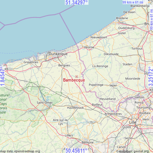
Bambecque GPS coordinates[2]
50° 54' 5.94" North, 2° 32' 54.96" East
| Map corner | latitude | longitude |
|---|---|---|
| Upper-left | 51.34297°, | 1.84547° |
| Center: | 50.90165°, | 2.5486° |
| Lower-right: | 50.45611°, | 3.25172° |
| Map W x H: | 98.6×98.6 km | = 61.3×61.3mi |
| max Lat: | 51.07786° ⇑0.3% North |
| Bambecque: | 50.90165° |
| min Lat: | ⇓99.7% South 41.3874° |
| min Long | Bambecque | max Long |
| -5.08615° | 2.5486° | 9.52242° |
| W 51.4%⇐ | ⇒48.6% E |
Elevation
Elevation of Bambecque is 9 m = 30 ft, and this is 184.7 m = 606 ft below average elevation for this country.
| Max E: |
2333 m = 7654 ft | 97.8% |
| Avg. | 193.7 m = 635 ft | |
| Bambecque | 9 m = 30 ft | |
Min E: |
-1 m = -3 ft | 2.2% |
See also: France elevation on elevation.city.
Geographical zone
Bambecque is located in North temperate zone (between Tropic of Cancer and the Arctic Circle). Distance of this North polar circle is 1741.4 km =1082.1 mi to North.| Distance of | km | miles | from Bambecque |
|---|---|---|---|
| North Pole | 4347.3 | 2701.3 | to North |
| Arctic Circle | 1741.4 | 1082.1 | to North |
| Tropic Cancer | 3053.8 | 1897.5 | to South |
| Equator | 5659.7 | 3516.8 | to South |


Nearby cities:
15 places around Bambecque: (largest is in red/bold)
• Esquelbecq
8.3 km =5.2 mi,  258°
258°
• Herzeele
2 km =1.2 mi,  208°
208°
• Hondschoote
8.8 km =5.5 mi,  16°
16°
• Houtkerque
4.3 km =2.7 mi,  129°
129°
• Killem
6.3 km =3.9 mi,  7°
7°
• Ledringhem
9.1 km =5.7 mi,  235°
235°
• Oudezeele
7.6 km =4.7 mi,  201°
201°
• Quaëdypre
7.6 km =4.7 mi,  299°
299°
• Rexpoëde
4.2 km =2.6 mi,  350°
350°
• Socx
9.5 km =5.9 mi,  293°
293°
• Steenvoorde
10.4 km =6.5 mi,  166°
166°
• Warhem
9.1 km =5.7 mi,  334°
334°
• West-Cappel
4.3 km =2.7 mi,  316°
316°
• Winnezeele
6.7 km =4.2 mi,  178°
178°
• Wormhout
6 km =3.7 mi,  247°
247°
Sources, notices
• [Note1] Compared only with cities in France existing in our database
• [Src1] Map data: © OpenStreetMap contributors (CC-BY-SA)
• [Src2] Other city data from geonames.org with taken over terms of usage.
• [Src3] Geographical zone / Annual Mean Temperature by Robert A. Rohde @ Wikipedia
