Herbignac geodata
Herbignac (Pays de la Loire) is a populated place; located in France in Europe/Paris (GMT+2) time zone. With population of 4,724 people, there are 2098 cities with bigger population in this country. Compared to other cities in France, 50.5% of cities are located further ↓South; 95.8% of cities are located further →East and 94.4% of cities have higher elevation than Herbignac. Note1
Administrative division(s):
- Level 1: Pays de la Loire
- Level 2: Loire-Atlantique
- Level 3: Arrondissement de Saint-Nazaire
- Level 4: Herbignac


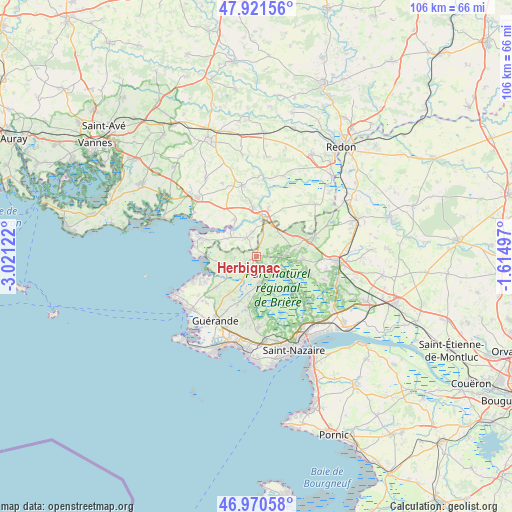
Herbignac GPS coordinates[2]
47° 26' 53.592" North, 2° 19' 5.16" West
| Map corner | latitude | longitude |
|---|---|---|
| Upper-left | 47.92156°, | -3.02122° |
| Center: | 47.44822°, | -2.3181° |
| Lower-right: | 46.97058°, | -1.61497° |
| Map W x H: | 105.7×105.7 km | = 65.7×65.7mi |
| max Lat: | 51.07786° ⇑49.5% North |
| Herbignac: | 47.44822° |
| min Lat: | ⇓50.5% South 41.3874° |
| min Long | Herbignac | max Long |
| -5.08615° | -2.3181° | 9.52242° |
| W 4.2%⇐ | ⇒95.8% E |
Elevation
Elevation of Herbignac is 19 m = 62 ft, and this is 174.7 m = 573 ft below average elevation for this country.
| Max E: |
2333 m = 7654 ft | 94.4% |
| Avg. | 193.7 m = 635 ft | |
| Herbignac | 19 m = 62 ft | |
Min E: |
-1 m = -3 ft | 5.6% |
See also: France elevation on elevation.city.
Geographical zone
Herbignac is located in North temperate zone (between Tropic of Cancer and the Arctic Circle). Distance of this North polar circle is 2125.4 km =1320.7 mi to North.| Distance of | km | miles | from Herbignac |
|---|---|---|---|
| North Pole | 4731.3 | 2939.9 | to North |
| Arctic Circle | 2125.4 | 1320.7 | to North |
| Tropic Cancer | 2669.8 | 1658.9 | to South |
| Equator | 5275.7 | 3278.2 | to South |


Nearby cities:
15 places around Herbignac: (largest is in red/bold)
• Arzal
8.8 km =5.5 mi,  330°
330°
• Assérac
5.8 km =3.6 mi,  248°
248°
• Camoël
6.9 km =4.3 mi,  302°
302°
• Crossac
11.9 km =7.4 mi,  110°
110°
• Férel
4.2 km =2.6 mi, 334°
• La Chapelle-des-Marais
6 km =3.7 mi,  89°
89°
• La Roche-Bernard
8 km =5 mi,  9°
9°
• Marzan
10.3 km =6.4 mi,  357°
357°
• Mesquer
12 km =7.5 mi,  242°
242°
• Nivillac
9.9 km =6.2 mi,  15°
15°
• Pénestin
12.2 km =7.6 mi,  288°
288°
• Saint-Joachim
11.9 km =7.4 mi,  127°
127°
• Saint-Lyphard
5.6 km =3.5 mi,  171°
171°
• Saint-Molf
10.1 km =6.3 mi,  231°
231°
• Sainte-Reine-de-Bretagne
9.5 km =5.9 mi, 94°
Sources, notices
• [Note1] Compared only with cities in France existing in our database
• [Src1] Map data: © OpenStreetMap contributors (CC-BY-SA)
• [Src2] Other city data from geonames.org with taken over terms of usage.
• [Src3] Geographical zone / Annual Mean Temperature by Robert A. Rohde @ Wikipedia
