Arnières-sur-Iton geodata
Arnières-sur-Iton (Normandy) is a populated place; located in France in Europe/Paris (GMT+2) time zone. With population of 1,607 people, there are 5813 cities with bigger population in this country. Compared to other cities in France, 79.6% of cities are located further ↓South; 67.8% of cities are located further →East and 67.4% of cities have higher elevation than Arnières-sur-Iton. Note1
Administrative division(s):
- Level 1: Normandy
- Level 2: Département de l'Eure
- Level 3: Arrondissement d’Évreux
- Level 4: Arnières-sur-Iton


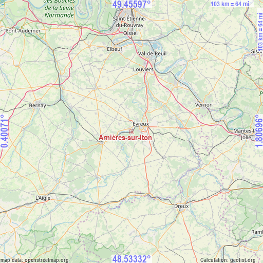
Arnières-sur-Iton GPS coordinates[2]
48° 59' 48.408" North, 1° 6' 13.824" East
| Map corner | latitude | longitude |
|---|---|---|
| Upper-left | 49.45597°, | 0.40071° |
| Center: | 48.99678°, | 1.10384° |
| Lower-right: | 48.53332°, | 1.80696° |
| Map W x H: | 102.6×102.6 km | = 63.8×63.8mi |
| max Lat: | 51.07786° ⇑20.4% North |
| Arnières-sur-Iton: | 48.99678° |
| min Lat: | ⇓79.6% South 41.3874° |
| min Long | Arnières-sur-I | max Long |
| -5.08615° | 1.10384° | 9.52242° |
| W 32.2%⇐ | ⇒67.8% E |
Elevation
Elevation of Arnières-sur-Iton is 84 m = 276 ft, and this is 109.7 m = 360 ft below average elevation for this country.
| Max E: |
2333 m = 7654 ft | 67.4% |
| Avg. | 193.7 m = 635 ft | |
| Arnières-sur-Iton | 84 m = 276 ft | |
Min E: |
-1 m = -3 ft | 32.6% |
See also: France elevation on elevation.city.
Geographical zone
Arnières-sur-Iton is located in North temperate zone (between Tropic of Cancer and the Arctic Circle). Distance of this North polar circle is 1953.2 km =1213.7 mi to North.| Distance of | km | miles | from Arnières-sur-Iton |
|---|---|---|---|
| North Pole | 4559.1 | 2832.9 | to North |
| Arctic Circle | 1953.2 | 1213.7 | to North |
| Tropic Cancer | 2842 | 1765.9 | to South |
| Equator | 5447.9 | 3385.2 | to South |


Nearby cities:
15 places around Arnières-sur-Iton: (largest is in red/bold)
• Aulnay-sur-Iton
3.2 km =2 mi,  268°
268°
• Aviron
6 km =3.7 mi,  8°
8°
• Caugé
6 km =3.7 mi,  301°
301°
• Claville
8.4 km =5.2 mi,  313°
313°
• Ferrières-Haut-Clocher
9.3 km =5.8 mi,  286°
286°
• Gauville-la-Campagne
5.5 km =3.4 mi,  349°
349°
• Glisolles
6.4 km =4 mi,  257°
257°
• Gravigny
7.9 km =4.9 mi,  37°
37°
• Guichainville
6.5 km =4 mi,  85°
85°
• Huest
8.8 km =5.5 mi,  57°
57°
• La Bonneville-sur-Iton
5.2 km =3.2 mi, 273°
• Le Plessis-Grohan
5.9 km =3.7 mi,  159°
159°
• Prey
8.5 km =5.3 mi,  115°
115°
• Saint-Sébastien-de-Morsent
2 km =1.2 mi,  322°
322°
• Évreux
4.6 km =2.9 mi,  48°
48°
Sources, notices
• [Note1] Compared only with cities in France existing in our database
• [Src1] Map data: © OpenStreetMap contributors (CC-BY-SA)
• [Src2] Other city data from geonames.org with taken over terms of usage.
• [Src3] Geographical zone / Annual Mean Temperature by Robert A. Rohde @ Wikipedia
