Uplistsikhe geodata
Uplistsikhe (Shida Kartli) is a populated place; located in Georgia in Asia/Tbilisi (GMT+4) time zone. With population of 728 people, there are 103 cities with bigger population in this country. Compared to other cities in Georgia, 53.8% of cities are located further ↑North; 70.9% of cities are located further ←West and 54.7% of cities have lower elevation than Uplistsikhe. Note1


Uplistsikhe GPS coordinates[2]
41° 57' 55.908" North, 44° 10' 16.284" East
| Map corner | latitude | longitude |
|---|---|---|
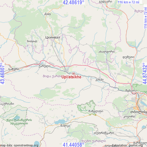
| Upper-left | 42.48619°, | 43.46807° |
| Center: | 41.96553°, | 44.17119° |
| Lower-right: | 41.44058°, | 44.87432° |
| Map W x H: | 116.3×116.3 km | = 72.3×72.3mi |
| max Lat: | 43.38111° ⇑53.8% North |
| Uplistsikhe: | 41.96553° |
| min Lat: | ⇓46.2% South 41.21725° |
| min Long | Uplistsikhe | max Long |
| 40.07944° | 44.17119° | 46.27667° |
| W 70.9%⇐ | ⇒29.1% E |
Elevation
Elevation of Uplistsikhe is 569 m = 1867 ft, and this is 9.8 m = 32 ft below average elevation for this country.
| Max E: |
2223 m = 7293 ft | 45.3% |
| Avg. | 578.8 m = 1899 ft | |
| Uplistsikhe | 569 m = 1867 ft | |
Min E: |
1 m = 3 ft | 54.7% |
See also: Georgia elevation on elevation.city.
Geographical zone
Uplistsikhe is located in North temperate zone (between Tropic of Cancer and the Arctic Circle). Distance of this Northern Tropic circle is 2060.2 km =1280.1 mi to South.| Distance of | km | miles | from Uplistsikhe |
|---|---|---|---|
| North Pole | 5340.9 | 3318.7 | to North |
| Arctic Circle | 2735 | 1699.4 | to North |
| Tropic Cancer | 2060.2 | 1280.1 | to South |
| Equator | 4666.1 | 2899.4 | to South |


Nearby cities:
15 places around Uplistsikhe: (largest is in red/bold)
• Agara
29.8 km =18.5 mi,  285°
285°
• Akhalgori
31.3 km =19.4 mi,  55°
55°
• Dzegvi
38 km =23.6 mi,  110°
110°
• Gori
5 km =3.1 mi, 294°
• Kaspi
21.5 km =13.4 mi,  102°
102°
• Khashuri
47.3 km =29.4 mi,  273°
273°
• Khet’agurovi
35.5 km =22.1 mi,  319°
319°
• Manglisi
34.7 km =21.6 mi,  149°
149°
• Mtskheta
47.2 km =29.3 mi, 106°
• Samt’avisi
20.3 km =12.6 mi,  76°
76°
• Tbeti
36.3 km =22.6 mi, 324°
• Tsalka
41.8 km =26 mi,  189°
189°
• Ts’khinvali
33.6 km =20.9 mi,  330°
330°
• Zahesi
50.7 km =31.5 mi, 108°
• Znaur
41.5 km =25.8 mi,  307°
307°
Sources, notices
• [Note1] Compared only with cities in Georgia existing in our database
• [Src1] Map data: © OpenStreetMap contributors (CC-BY-SA)
• [Src2] Other city data from geonames.org with taken over terms of usage.
• [Src3] Geographical zone / Annual Mean Temperature by Robert A. Rohde @ Wikipedia
