Surami geodata
Surami (Shida Kartli) is a populated place; located in Georgia in Asia/Tbilisi (GMT+4) time zone. With population of 10,091 people, there are 32 cities with bigger population in this country. Compared to other cities in Georgia, 51.3% of cities are located further ↓South; 60.7% of cities are located further ←West and 66.7% of cities have lower elevation than Surami. Note1


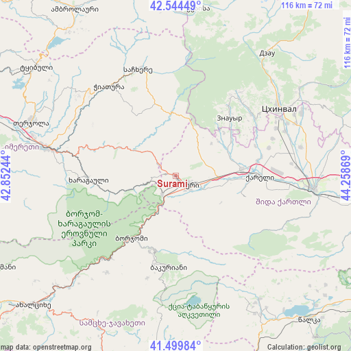
Surami GPS coordinates[2]
42° 1' 27.516" North, 43° 33' 20.016" East
| Map corner | latitude | longitude |
|---|---|---|
| Upper-left | 42.54449°, | 42.85244° |
| Center: | 42.02431°, | 43.55556° |
| Lower-right: | 41.49984°, | 44.25869° |
| Map W x H: | 116.2×116.2 km | = 72.2×72.2mi |
| max Lat: | 43.38111° ⇑48.7% North |
| Surami: | 42.02431° |
| min Lat: | ⇓51.3% South 41.21725° |
| min Long | Surami | max Long |
| 40.07944° | 43.55556° | 46.27667° |
| W 60.7%⇐ | ⇒39.3% E |
Elevation
Elevation of Surami is 745 m = 2444 ft, and this is 166.2 m = 545 ft above average elevation for this country.
| Max E: |
2223 m = 7293 ft | 33.3% |
| Surami | 745 m 2444 ft | |
| Avg. | 578.8 m = 1899 ft | |
Min E: |
1 m = 3 ft | 66.7% |
See also: Georgia elevation on elevation.city.
Geographical zone
Surami is located in North temperate zone (between Tropic of Cancer and the Arctic Circle). Distance of this Northern Tropic circle is 2066.7 km =1284.2 mi to South.| Distance of | km | miles | from Surami |
|---|---|---|---|
| North Pole | 5334.4 | 3314.6 | to North |
| Arctic Circle | 2728.5 | 1695.4 | to North |
| Tropic Cancer | 2066.7 | 1284.2 | to South |
| Equator | 4672.7 | 2903.5 | to South |


Nearby cities:
15 places around Surami: (largest is in red/bold)
• Agara
22.2 km =13.8 mi,  86°
86°
• Akhaldaba
11.9 km =7.4 mi,  208°
208°
• Bakuriani
30.6 km =19 mi,  183°
183°
• Bakurianis Andeziti
33 km =20.5 mi,  192°
192°
• Borjomi
22.4 km =13.9 mi, 211°
• Chiat’ura
37.1 km =23.1 mi,  325°
325°
• Kharagauli
29.6 km =18.4 mi,  269°
269°
• Khashuri
5 km =3.1 mi,  132°
132°
• Khet’agurovi
34.5 km =21.4 mi,  53°
53°
• Sach’khere
37.4 km =23.2 mi,  342°
342°
• Shorapani
39.4 km =24.5 mi,  280°
280°
• Tbeti
37.3 km =23.2 mi, 52°
• Tsaghveri
25.3 km =15.7 mi, 193°
• Ts’khinvali
40.9 km =25.4 mi,  56°
56°
• Znaur
26.1 km =16.2 mi,  43°
43°
Sources, notices
• [Note1] Compared only with cities in Georgia existing in our database
• [Src1] Map data: © OpenStreetMap contributors (CC-BY-SA)
• [Src2] Other city data from geonames.org with taken over terms of usage.
• [Src3] Geographical zone / Annual Mean Temperature by Robert A. Rohde @ Wikipedia
