Chiat’ura geodata
Chiat’ura (Imereti) is a populated place; located in Georgia in Asia/Tbilisi (GMT+4) time zone. With population of 12,803 people, there are 26 cities with bigger population in this country. Compared to other cities in Georgia, 69.2% of cities are located further ↓South; 53% of cities are located further ←West and 50.4% of cities have lower elevation than Chiat’ura. Note1


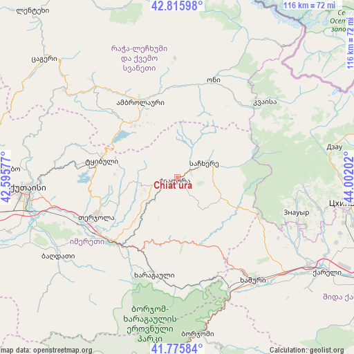
Chiat’ura GPS coordinates[2]
42° 17' 53.016" North, 43° 17' 56.004" East
| Map corner | latitude | longitude |
|---|---|---|
| Upper-left | 42.81598°, | 42.59577° |
| Center: | 42.29806°, | 43.29889° |
| Lower-right: | 41.77584°, | 44.00202° |
| Map W x H: | 115.7×115.7 km | = 71.9×71.9mi |
| max Lat: | 43.38111° ⇑30.8% North |
| Chiat’ura: | 42.29806° |
| min Lat: | ⇓69.2% South 41.21725° |
| min Long | Chiat’ura | max Long |
| 40.07944° | 43.29889° | 46.27667° |
| W 53%⇐ | ⇒47% E |
Elevation
Elevation of Chiat’ura is 495 m = 1624 ft, and this is 83.8 m = 275 ft below average elevation for this country.
| Max E: |
2223 m = 7293 ft | 49.6% |
| Avg. | 578.8 m = 1899 ft | |
| Chiat’ura | 495 m = 1624 ft | |
Min E: |
1 m = 3 ft | 50.4% |
See also: Georgia elevation on elevation.city.
Geographical zone
Chiat’ura is located in North temperate zone (between Tropic of Cancer and the Arctic Circle). Distance of this Northern Tropic circle is 2097.2 km =1303.1 mi to South.| Distance of | km | miles | from Chiat’ura |
|---|---|---|---|
| North Pole | 5304 | 3295.8 | to North |
| Arctic Circle | 2698.1 | 1676.5 | to North |
| Tropic Cancer | 2097.2 | 1303.1 | to South |
| Equator | 4703.1 | 2922.4 | to South |


Nearby cities:
15 places around Chiat’ura: (largest is in red/bold)
• Akhaldaba
43.8 km =27.2 mi,  159°
159°
• Ambrolauri
27.2 km =16.9 mi,  335°
335°
• Gori
26.6 km =16.5 mi, 335°
• Kats’khi
7.4 km =4.6 mi,  265°
265°
• Kharagauli
31.9 km =19.8 mi,  195°
195°
• Khashuri
41.9 km =26 mi,  143°
143°
• Khet’agurovi
49.9 km =31 mi,  101°
101°
• Kutaisi
49.8 km =30.9 mi, 266°
• Oni
33.4 km =20.8 mi,  20°
20°
• Sach’khere
11.2 km =7 mi,  62°
62°
• Shorapani
29 km =18 mi,  217°
217°
• Surami
37.1 km =23.1 mi,  145°
145°
• Tqibuli
25.4 km =15.8 mi,  283°
283°
• Zestap’oni
29.1 km =18.1 mi, 224°
• Znaur
40.7 km =25.3 mi,  106°
106°
Sources, notices
• [Note1] Compared only with cities in Georgia existing in our database
• [Src1] Map data: © OpenStreetMap contributors (CC-BY-SA)
• [Src2] Other city data from geonames.org with taken over terms of usage.
• [Src3] Geographical zone / Annual Mean Temperature by Robert A. Rohde @ Wikipedia
