Samtredia geodata
Samtredia (Imereti) is a populated place; located in Georgia in Asia/Tbilisi (GMT+4) time zone. With population of 28,748 people, there are 9 cities with bigger population in this country. Compared to other cities in Georgia, 60.7% of cities are located further ↓South; 66.7% of cities are located further →East and 83.8% of cities have higher elevation than Samtredia. Note1


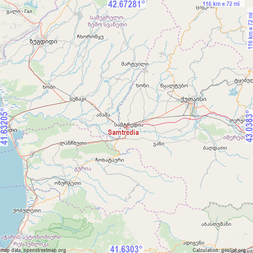
Samtredia GPS coordinates[2]
42° 9' 13.32" North, 42° 20' 6.612" East
| Map corner | latitude | longitude |
|---|---|---|
| Upper-left | 42.67281°, | 41.63205° |
| Center: | 42.1537°, | 42.33517° |
| Lower-right: | 41.6303°, | 43.0383° |
| Map W x H: | 115.9×115.9 km | = 72×72mi |
| max Lat: | 43.38111° ⇑39.3% North |
| Samtredia: | 42.1537° |
| min Lat: | ⇓60.7% South 41.21725° |
| min Long | Samtredia | max Long |
| 40.07944° | 42.33517° | 46.27667° |
| W 33.3%⇐ | ⇒66.7% E |
Elevation
Elevation of Samtredia is 23 m = 75 ft, and this is 555.8 m = 1823 ft below average elevation for this country.
| Max E: |
2223 m = 7293 ft | 83.8% |
| Avg. | 578.8 m = 1899 ft | |
| Samtredia | 23 m = 75 ft | |
Min E: |
1 m = 3 ft | 16.2% |
See also: Georgia elevation on elevation.city.
Geographical zone
Samtredia is located in North temperate zone (between Tropic of Cancer and the Arctic Circle). Distance of this Northern Tropic circle is 2081.1 km =1293.1 mi to South.| Distance of | km | miles | from Samtredia |
|---|---|---|---|
| North Pole | 5320 | 3305.7 | to North |
| Arctic Circle | 2714.1 | 1686.5 | to North |
| Tropic Cancer | 2081.1 | 1293.1 | to South |
| Equator | 4687.1 | 2912.4 | to South |


Nearby cities:
15 places around Samtredia: (largest is in red/bold)
• Abasha
11.3 km =7 mi,  303°
303°
• Khobi
40.2 km =25 mi, 296°
• Khoni
20.1 km =12.5 mi,  20°
20°
• Kutaisi
32.2 km =20 mi,  66°
66°
• Kveda Chkhorots’q’u
41.3 km =25.7 mi,  331°
331°
• K’ulashi
5.6 km =3.5 mi,  6°
6°
• Lanchkhuti
25.9 km =16.1 mi,  254°
254°
• Mart’vili
29.2 km =18.1 mi, 7°
• Naruja
41.7 km =25.9 mi,  228°
228°
• Ochkhamuri
51.5 km =32 mi, 230°
• Ozurgeti
37.2 km =23.1 mi, 226°
• Senak’i
25.6 km =15.9 mi, 300°
• Tsqaltubo
30 km =18.6 mi,  46°
46°
• Urek’i
49.2 km =30.6 mi, 249°
• Vani
17.3 km =10.7 mi,  117°
117°
Sources, notices
• [Note1] Compared only with cities in Georgia existing in our database
• [Src1] Map data: © OpenStreetMap contributors (CC-BY-SA)
• [Src2] Other city data from geonames.org with taken over terms of usage.
• [Src3] Geographical zone / Annual Mean Temperature by Robert A. Rohde @ Wikipedia
