Kveda Chkhorots’q’u geodata
Kveda Chkhorots’q’u (Samegrelo and Zemo Svaneti) is a populated place; located in Georgia in Asia/Tbilisi (GMT+4) time zone. With population of 4,357 people, there are 59 cities with bigger population in this country. Compared to other cities in Georgia, 78.6% of cities are located further ↓South; 70.9% of cities are located further →East and 70.9% of cities have higher elevation than Kveda Chkhorots’q’u. Note1


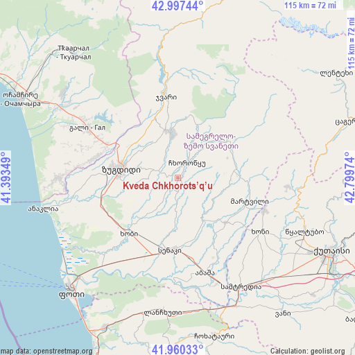
Kveda Chkhorots’q’u GPS coordinates[2]
42° 28' 51.708" North, 42° 5' 47.796" East
| Map corner | latitude | longitude |
|---|---|---|
| Upper-left | 42.99744°, | 41.39349° |
| Center: | 42.48103°, | 42.09661° |
| Lower-right: | 41.96033°, | 42.79974° |
| Map W x H: | 115.3×115.3 km | = 71.6×71.6mi |
| max Lat: | 43.38111° ⇑21.4% North |
| Kveda Chkhorots’q’u: | 42.48103° |
| min Lat: | ⇓78.6% South 41.21725° |
| min Long | Kveda Chkhorots | max Long |
| 40.07944° | 42.09661° | 46.27667° |
| W 29.1%⇐ | ⇒70.9% E |
Elevation
Elevation of Kveda Chkhorots’q’u is 125 m = 410 ft, and this is 453.8 m = 1489 ft below average elevation for this country.
| Max E: |
2223 m = 7293 ft | 70.9% |
| Avg. | 578.8 m = 1899 ft | |
| Kveda Chkhorots’q’u | 125 m = 410 ft | |
Min E: |
1 m = 3 ft | 29.1% |
See also: Georgia elevation on elevation.city.
Geographical zone
Kveda Chkhorots’q’u is located in North temperate zone (between Tropic of Cancer and the Arctic Circle). Distance of this Northern Tropic circle is 2117.5 km =1315.8 mi to South.| Distance of | km | miles | from Kveda Chkhorots’q’u |
|---|---|---|---|
| North Pole | 5283.6 | 3283.1 | to North |
| Arctic Circle | 2677.7 | 1663.8 | to North |
| Tropic Cancer | 2117.5 | 1315.8 | to South |
| Equator | 4723.4 | 2935 | to South |


Nearby cities:
15 places around Kveda Chkhorots’q’u: (largest is in red/bold)
• Abasha
31.9 km =19.8 mi,  161°
161°
• Gali
33.5 km =20.8 mi,  298°
298°
• Jvari
26.5 km =16.5 mi,  352°
352°
• Khobi
24.5 km =15.2 mi,  221°
221°
• Khoni
31.9 km =19.8 mi,  123°
123°
• K’ulashi
36.9 km =22.9 mi,  146°
146°
• Lanchkhuti
43.8 km =27.2 mi,  186°
186°
• Mart’vili
24.3 km =15.1 mi,  107°
107°
• Orsant’ia
34.7 km =21.6 mi,  267°
267°
• P’ot’i
51 km =31.7 mi, 223°
• Samtredia
41.3 km =25.7 mi, 151°
• Senak’i
23.5 km =14.6 mi, 185°
• Tsalenjikha
13.9 km =8.6 mi, 350°
• Tsqaltubo
44 km =27.3 mi, 110°
• Zugdidi
18.8 km =11.7 mi,  279°
279°
Sources, notices
• [Note1] Compared only with cities in Georgia existing in our database
• [Src1] Map data: © OpenStreetMap contributors (CC-BY-SA)
• [Src2] Other city data from geonames.org with taken over terms of usage.
• [Src3] Geographical zone / Annual Mean Temperature by Robert A. Rohde @ Wikipedia
