Adigeni geodata
Adigeni (Samtskhe-Javakheti) is a populated place; located in Georgia in Asia/Tbilisi (GMT+4) time zone. With population of 1,313 people, there are 93 cities with bigger population in this country. Compared to other cities in Georgia, 77.8% of cities are located further ↑North; 59.8% of cities are located further →East and 90.6% of cities have lower elevation than Adigeni. Note1


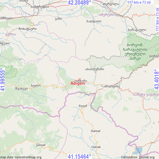
Adigeni GPS coordinates[2]
41° 40' 54.876" North, 42° 41' 55.212" East
| Map corner | latitude | longitude |
|---|---|---|
| Upper-left | 42.20489°, | 41.99555° |
| Center: | 41.68191°, | 42.69867° |
| Lower-right: | 41.15464°, | 43.4018° |
| Map W x H: | 116.8×116.8 km | = 72.6×72.6mi |
| max Lat: | 43.38111° ⇑77.8% North |
| Adigeni: | 41.68191° |
| min Lat: | ⇓22.2% South 41.21725° |
| min Long | Adigeni | max Long |
| 40.07944° | 42.69867° | 46.27667° |
| W 40.2%⇐ | ⇒59.8% E |
Elevation
Elevation of Adigeni is 1253 m = 4111 ft, and this is 674.2 m = 2212 ft above average elevation for this country.
| Max E: |
2223 m = 7293 ft | 9.4% |
| Adigeni | 1253 m 4111 ft | |
| Avg. | 578.8 m = 1899 ft | |
Min E: |
1 m = 3 ft | 90.6% |
See also: Georgia elevation on elevation.city.
Geographical zone
Adigeni is located in North temperate zone (between Tropic of Cancer and the Arctic Circle). Distance of this Northern Tropic circle is 2028.7 km =1260.6 mi to South.| Distance of | km | miles | from Adigeni |
|---|---|---|---|
| North Pole | 5372.5 | 3338.3 | to North |
| Arctic Circle | 2766.6 | 1719.1 | to North |
| Tropic Cancer | 2028.7 | 1260.6 | to South |
| Equator | 4634.6 | 2879.8 | to South |


Nearby cities:
15 places around Adigeni: (largest is in red/bold)
• Abastumani
12.5 km =7.8 mi,  76°
76°
• Akhaldaba
45.5 km =28.3 mi,  266°
266°
• Akhaltsikhe
24.1 km =15 mi,  101°
101°
• Aspindza
47.2 km =29.3 mi, 104°
• Borjomi
62.2 km =38.6 mi,  72°
72°
• Dioknisi
26.2 km =16.3 mi,  257°
257°
• Kharagauli
56 km =34.8 mi,  47°
47°
• Khert’visi
53.8 km =33.4 mi,  114°
114°
• Khulo
33.1 km =20.6 mi, 262°
• Samtredia
60.5 km =37.6 mi,  330°
330°
• Shorapani
55.6 km =34.5 mi,  35°
35°
• Shuakhevi
42.6 km =26.5 mi, 262°
• Vale
16.2 km =10.1 mi,  117°
117°
• Vani
47 km =29.2 mi,  341°
341°
• Zestap’oni
55.9 km =34.7 mi,  31°
31°
Sources, notices
• [Note1] Compared only with cities in Georgia existing in our database
• [Src1] Map data: © OpenStreetMap contributors (CC-BY-SA)
• [Src2] Other city data from geonames.org with taken over terms of usage.
• [Src3] Geographical zone / Annual Mean Temperature by Robert A. Rohde @ Wikipedia
