Serekunda geodata
Serekunda (Banjul) is a populated place; located in Gambia in Africa/Banjul (GMT+0) time zone. With population of 340,000 people, there are 0 cities with bigger population in this country. Compared to other cities in Gambia, 52% of cities are located further ↑North; 97.6% of cities are located further →East and 70.7% of cities have higher elevation than Serekunda. Note1


Serekunda GPS coordinates[2]
13° 26' 17.988" North, 16° 40' 41.016" West
| Map corner | latitude | longitude |
|---|---|---|
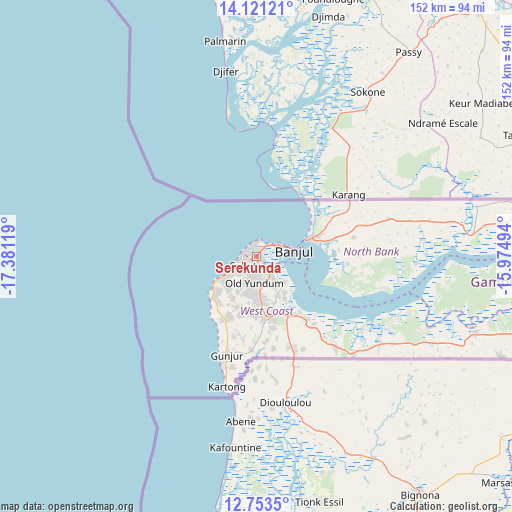
| Upper-left | 14.12121°, | -17.38119° |
| Center: | 13.43833°, | -16.67806° |
| Lower-right: | 12.7535°, | -15.97494° |
| Map W x H: | 152.1×152.1 km | = 94.5×94.5mi |
| max Lat: | 13.8° ⇑52% North |
| Serekunda: | 13.43833° |
| min Lat: | ⇓48% South 13.20194° |
| min Long | Serekunda | max Long |
| -16.73389° | -16.67806° | -13.85° |
| W 2.4%⇐ | ⇒97.6% E |
Elevation
Elevation of Serekunda is 15 m = 49 ft, and this is 6.1 m = 20 ft below average elevation for this country.
| Max E: |
49 m = 161 ft | 70.7% |
| Avg. | 21.1 m = 69 ft | |
| Serekunda | 15 m = 49 ft | |
Min E: |
1 m = 3 ft | 29.3% |
See also: Serekunda elevation on elevation.city.
Geographical zone
Serekunda is located in North Torrid zone (between Equator and Tropic of Cancer). Distance of this Northern Tropic circle is 1111.7 km =690.8 mi to North.| Distance of | km | miles | from Serekunda |
|---|---|---|---|
| North Pole | 8512.9 | 5289.7 | to North |
| Arctic Circle | 5907 | 3670.4 | to North |
| Tropic Cancer | 1111.7 | 690.8 | to North |
| Equator | 1494.2 | 928.5 | to South |


Nearby cities:
15 places around Serekunda: (largest is in red/bold)
• Abuko
4.5 km =2.8 mi,  147°
147°
• Bakau
4.4 km =2.7 mi,  354°
354°
• Banjul
10.9 km =6.8 mi,  81°
81°
• Barra
15.2 km =9.4 mi,  70°
70°
• Brikama
18.8 km =11.7 mi,  170°
170°
• Chilla
44.4 km =27.6 mi, 73°
• Essau
16.3 km =10.1 mi, 71°
• Gunjur
27 km =16.8 mi,  192°
192°
• Janneh Kunda
58.7 km =36.5 mi,  96°
96°
• Kerewan
64 km =39.8 mi, 84°
• Lamin
28.1 km =17.5 mi,  109°
109°
• Medina Kanuma
17.8 km =11.1 mi, 70°
• Somita
47.9 km =29.8 mi,  122°
122°
• Sukuta
4.5 km =2.8 mi,  226°
226°
• Tambana
55 km =34.2 mi, 82°
Sources, notices
• [Note1] Compared only with cities in Gambia existing in our database
• [Src1] Map data: © OpenStreetMap contributors (CC-BY-SA)
• [Src2] Other city data from geonames.org with taken over terms of usage.
• [Src3] Geographical zone / Annual Mean Temperature by Robert A. Rohde @ Wikipedia
