Zéli geodata
Zéli (Central Greece) is a populated place; located in Greece in Europe/Athens (GMT+3) time zone. With population of 673 people, there are 1456 cities with bigger population in this country. Compared to other cities in Greece, 58.8% of cities are located further ↑North; 50.9% of cities are located further ←West and 89.6% of cities have lower elevation than Zéli. Note1
Administrative division(s):
- Level 1: Central Greece
- Level 2: Nomós Fthiótidos
- Level 3: Dimos Amfikleia-Elateia


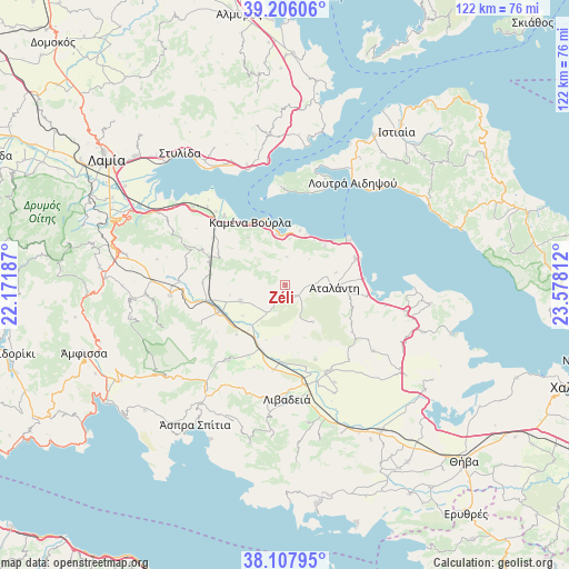
Zéli GPS coordinates[2]
38° 39' 32.796" North, 22° 52' 29.964" East
| Map corner | latitude | longitude |
|---|---|---|
| Upper-left | 39.20606°, | 22.17187° |
| Center: | 38.65911°, | 22.87499° |
| Lower-right: | 38.10795°, | 23.57812° |
| Map W x H: | 122.1×122.1 km | = 75.9×75.9mi |
| max Lat: | 41.72048° ⇑58.8% North |
| Zéli: | 38.65911° |
| min Lat: | ⇓41.2% South 34.8346° |
| min Long | Zéli | max Long |
| 19.40494° | 22.87499° | 29.59361° |
| W 50.9%⇐ | ⇒49.1% E |
Elevation
Elevation of Zéli is 501 m = 1644 ft, and this is 332.1 m = 1090 ft above average elevation for this country.
| Max E: |
1439 m = 4721 ft | 10.4% |
| Zéli | 501 m 1644 ft | |
| Avg. | 168.9 m = 554 ft | |
Min E: |
0 m = 0 ft | 89.6% |
See also: Greece elevation on elevation.city.
Geographical zone
Zéli is located in North temperate zone (between Tropic of Cancer and the Arctic Circle). Distance of this Northern Tropic circle is 1692.6 km =1051.7 mi to South.| Distance of | km | miles | from Zéli |
|---|---|---|---|
| North Pole | 5708.6 | 3547.2 | to North |
| Arctic Circle | 3102.7 | 1927.9 | to North |
| Tropic Cancer | 1692.6 | 1051.7 | to South |
| Equator | 4298.5 | 2671 | to South |


Nearby cities:
15 places around Zéli: (largest is in red/bold)
• Arkítsa
16.6 km =10.3 mi,  55°
55°
• Atalánti
10.8 km =6.7 mi,  94°
94°
• Chairóneia
18.4 km =11.4 mi,  188°
188°
• Eláteia
10.2 km =6.3 mi,  249°
249°
• Kainoúryion
19.8 km =12.3 mi,  318°
318°
• Kaména Voúrla
15.4 km =9.6 mi,  329°
329°
• Káto Tithoréa
15.2 km =9.4 mi, 247°
• Livanátes
16.3 km =10.1 mi,  69°
69°
• Orchomenós
20.6 km =12.8 mi,  153°
153°
• Rengínion
15.8 km =9.8 mi,  295°
295°
• Tithoréa
19.8 km =12.3 mi, 245°
• Ágios Geórgios Lichádos
19.9 km =12.4 mi,  1°
1°
• Áyios Konstandínos
10.9 km =6.8 mi,  352°
352°
• Áyios Serafím
21.6 km =13.4 mi, 316°
• Éxarkhos
10 km =6.2 mi,  142°
142°
Sources, notices
• [Note1] Compared only with cities in Greece existing in our database
• [Src1] Map data: © OpenStreetMap contributors (CC-BY-SA)
• [Src2] Other city data from geonames.org with taken over terms of usage.
• [Src3] Geographical zone / Annual Mean Temperature by Robert A. Rohde @ Wikipedia
