Kaména Voúrla geodata
Kaména Voúrla (Central Greece) is a seat of a third-order administrative division; located in Greece in Europe/Athens (GMT+3) time zone. With population of 2,761 people, there are 379 cities with bigger population in this country. Compared to other cities in Greece, 57.8% of cities are located further ↑North; 52.1% of cities are located further →East and 90.7% of cities have higher elevation than Kaména Voúrla. Note1
Administrative division(s):
- Level 1: Central Greece
- Level 2: Nomós Fthiótidos
- Level 3: Dimos Molos-Agios Konstantinos


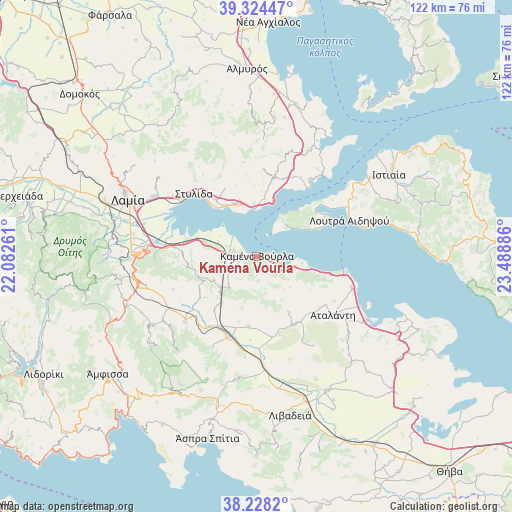
Kaména Voúrla GPS coordinates[2]
38° 46' 42.384" North, 22° 47' 8.628" East
| Map corner | latitude | longitude |
|---|---|---|
| Upper-left | 39.32447°, | 22.08261° |
| Center: | 38.77844°, | 22.78573° |
| Lower-right: | 38.2282°, | 23.48886° |
| Map W x H: | 121.9×121.9 km | = 75.7×75.7mi |
| max Lat: | 41.72048° ⇑57.8% North |
| Kaména Voúrla: | 38.77844° |
| min Lat: | ⇓42.2% South 34.8346° |
| min Long | Kaména Voúrla | max Long |
| 19.40494° | 22.78573° | 29.59361° |
| W 47.9%⇐ | ⇒52.1% E |
Elevation
Elevation of Kaména Voúrla is 8 m = 26 ft, and this is 160.9 m = 528 ft below average elevation for this country.
| Max E: |
1439 m = 4721 ft | 90.7% |
| Avg. | 168.9 m = 554 ft | |
| Kaména Voúrla | 8 m = 26 ft | |
Min E: |
0 m = 0 ft | 9.3% |
See also: Greece elevation on elevation.city.
Geographical zone
Kaména Voúrla is located in North temperate zone (between Tropic of Cancer and the Arctic Circle). Distance of this Northern Tropic circle is 1705.8 km =1059.9 mi to South.| Distance of | km | miles | from Kaména Voúrla |
|---|---|---|---|
| North Pole | 5695.3 | 3538.9 | to North |
| Arctic Circle | 3089.4 | 1919.7 | to North |
| Tropic Cancer | 1705.8 | 1059.9 | to South |
| Equator | 4311.8 | 2679.2 | to South |


Nearby cities:
15 places around Kaména Voúrla: (largest is in red/bold)
• Akhinós
13.8 km =8.6 mi,  337°
337°
• Eláteia
16.9 km =10.5 mi,  186°
186°
• Giáltra
19 km =11.8 mi,  60°
60°
• Kainoúryion
5.5 km =3.4 mi,  286°
286°
• Karavómilos
14 km =8.7 mi,  331°
331°
• Káto Tithoréa
20 km =12.4 mi,  198°
198°
• Mólos
12.7 km =7.9 mi, 286°
• Paralía Rachón
11.5 km =7.1 mi,  356°
356°
• Pelasgía
19.4 km =12.1 mi,  13°
13°
• Rengínion
9.3 km =5.8 mi,  225°
225°
• Rákhai
12.5 km =7.8 mi, 358°
• Zéli
15.4 km =9.6 mi,  149°
149°
• Ágios Geórgios Lichádos
10.6 km =6.6 mi,  51°
51°
• Áyios Konstandínos
6.7 km =4.2 mi,  111°
111°
• Áyios Serafím
7.5 km =4.7 mi, 289°
Sources, notices
• [Note1] Compared only with cities in Greece existing in our database
• [Src1] Map data: © OpenStreetMap contributors (CC-BY-SA)
• [Src2] Other city data from geonames.org with taken over terms of usage.
• [Src3] Geographical zone / Annual Mean Temperature by Robert A. Rohde @ Wikipedia
