Rengínion geodata
Rengínion (Central Greece) is a populated place; located in Greece in Europe/Athens (GMT+3) time zone. With population of 577 people, there are 1632 cities with bigger population in this country. Compared to other cities in Greece, 58.2% of cities are located further ↑North; 54.9% of cities are located further →East and 71.8% of cities have lower elevation than Rengínion. Note1
Administrative division(s):
- Level 1: Central Greece
- Level 2: Nomós Fthiótidos
- Level 3: Dimos Molos-Agios Konstantinos


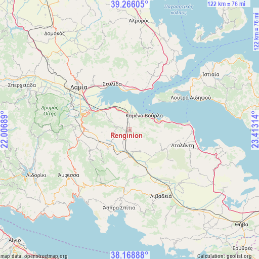
Rengínion GPS coordinates[2]
38° 43' 10.452" North, 22° 42' 36.036" East
| Map corner | latitude | longitude |
|---|---|---|
| Upper-left | 39.26605°, | 22.00689° |
| Center: | 38.71957°, | 22.71001° |
| Lower-right: | 38.16888°, | 23.41314° |
| Map W x H: | 122×122 km | = 75.8×75.8mi |
| max Lat: | 41.72048° ⇑58.2% North |
| Rengínion: | 38.71957° |
| min Lat: | ⇓41.8% South 34.8346° |
| min Long | Rengínion | max Long |
| 19.40494° | 22.71001° | 29.59361° |
| W 45.1%⇐ | ⇒54.9% E |
Elevation
Elevation of Rengínion is 179 m = 587 ft, and this is 10.1 m = 33 ft above average elevation for this country.
| Max E: |
1439 m = 4721 ft | 28.2% |
| Rengínion | 179 m 587 ft | |
| Avg. | 168.9 m = 554 ft | |
Min E: |
0 m = 0 ft | 71.8% |
See also: Greece elevation on elevation.city.
Geographical zone
Rengínion is located in North temperate zone (between Tropic of Cancer and the Arctic Circle). Distance of this Northern Tropic circle is 1699.3 km =1055.9 mi to South.| Distance of | km | miles | from Rengínion |
|---|---|---|---|
| North Pole | 5701.8 | 3542.9 | to North |
| Arctic Circle | 3096 | 1923.8 | to North |
| Tropic Cancer | 1699.3 | 1055.9 | to South |
| Equator | 4305.2 | 2675.1 | to South |


Nearby cities:
15 places around Rengínion: (largest is in red/bold)
• Akhinós
19.3 km =12 mi,  3°
3°
• Amfíkleia
13.6 km =8.5 mi,  228°
228°
• Eláteia
11.3 km =7 mi,  154°
154°
• Kainoúryion
8.2 km =5.1 mi,  8°
8°
• Kaména Voúrla
9.3 km =5.8 mi,  45°
45°
• Karavómilos
18.8 km =11.7 mi,  359°
359°
• Káto Tithoréa
12.5 km =7.8 mi,  178°
178°
• Mólos
11.5 km =7.1 mi,  330°
330°
• Paralía Rachón
19 km =11.8 mi,  17°
17°
• Rákhai
20 km =12.4 mi, 17°
• Tithoréa
15.5 km =9.6 mi,  193°
193°
• Zéli
15.8 km =9.8 mi,  115°
115°
• Ágios Geórgios Lichádos
19.8 km =12.3 mi, 48°
• Áyios Konstandínos
13.4 km =8.3 mi,  72°
72°
• Áyios Serafím
9.1 km =5.7 mi, 356°
Sources, notices
• [Note1] Compared only with cities in Greece existing in our database
• [Src1] Map data: © OpenStreetMap contributors (CC-BY-SA)
• [Src2] Other city data from geonames.org with taken over terms of usage.
• [Src3] Geographical zone / Annual Mean Temperature by Robert A. Rohde @ Wikipedia
