Livanátes geodata
Livanátes (Central Greece) is a populated place; located in Greece in Europe/Athens (GMT+3) time zone. With population of 2,559 people, there are 410 cities with bigger population in this country. Compared to other cities in Greece, 58.3% of cities are located further ↑North; 56.3% of cities are located further ←West and 62.1% of cities have higher elevation than Livanátes. Note1


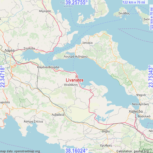
Livanátes GPS coordinates[2]
38° 42' 39.6" North, 23° 3' 1.08" East
| Map corner | latitude | longitude |
|---|---|---|
| Upper-left | 39.25755°, | 22.34718° |
| Center: | 38.711°, | 23.0503° |
| Lower-right: | 38.16024°, | 23.75343° |
| Map W x H: | 122×122 km | = 75.8×75.8mi |
| max Lat: | 41.72048° ⇑58.3% North |
| Livanátes: | 38.711° |
| min Lat: | ⇓41.7% South 34.8346° |
| min Long | Livanátes | max Long |
| 19.40494° | 23.0503° | 29.59361° |
| W 56.3%⇐ | ⇒43.7% E |
Elevation
Elevation of Livanátes is 45 m = 148 ft, and this is 123.9 m = 406 ft below average elevation for this country.
| Max E: |
1439 m = 4721 ft | 62.1% |
| Avg. | 168.9 m = 554 ft | |
| Livanátes | 45 m = 148 ft | |
Min E: |
0 m = 0 ft | 37.9% |
See also: Greece elevation on elevation.city.
Geographical zone
Livanátes is located in North temperate zone (between Tropic of Cancer and the Arctic Circle). Distance of this Northern Tropic circle is 1698.3 km =1055.3 mi to South.| Distance of | km | miles | from Livanátes |
|---|---|---|---|
| North Pole | 5702.8 | 3543.6 | to North |
| Arctic Circle | 3096.9 | 1924.3 | to North |
| Tropic Cancer | 1698.3 | 1055.3 | to South |
| Equator | 4304.3 | 2674.6 | to South |


Nearby cities:
15 places around Livanátes: (largest is in red/bold)
• Aidipsós
18.7 km =11.6 mi,  359°
359°
• Arkítsa
3.9 km =2.4 mi,  337°
337°
• Atalánti
8 km =5 mi,  213°
213°
• Giáltra
18.1 km =11.2 mi, 339°
• Loutrá Aidhipsoú
16.2 km =10.1 mi, 359°
• Límni
23.9 km =14.9 mi,  75°
75°
• Malesína
18.7 km =11.6 mi,  121°
121°
• Martínon
21.3 km =13.2 mi,  138°
138°
• Roviés
19.1 km =11.9 mi,  54°
54°
• Tragána
11.9 km =7.4 mi,  148°
148°
• Zéli
16.3 km =10.1 mi,  249°
249°
• Ágios Geórgios Lichádos
20.4 km =12.7 mi,  313°
313°
• Áyios
21.5 km =13.4 mi,  2°
2°
• Áyios Konstandínos
17.5 km =10.9 mi,  286°
286°
• Éxarkhos
16.5 km =10.3 mi, 213°
Sources, notices
• [Note1] Compared only with cities in Greece existing in our database
• [Src1] Map data: © OpenStreetMap contributors (CC-BY-SA)
• [Src2] Other city data from geonames.org with taken over terms of usage.
• [Src3] Geographical zone / Annual Mean Temperature by Robert A. Rohde @ Wikipedia
