Gialós geodata
Gialós (Crete) is a populated place; located in Greece in Europe/Athens (GMT+3) time zone. With population of 873 people, there are 1168 cities with bigger population in this country. Compared to other cities in Greece, 97.5% of cities are located further ↑North; 67.7% of cities are located further ←West and 64.1% of cities have higher elevation than Gialós. Note1


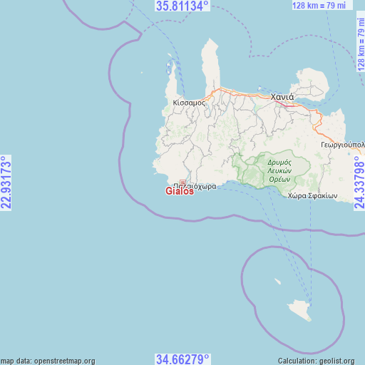
Gialós GPS coordinates[2]
35° 14' 20.76" North, 23° 38' 5.46" East
| Map corner | latitude | longitude |
|---|---|---|
| Upper-left | 35.81134°, | 22.93173° |
| Center: | 35.2391°, | 23.63485° |
| Lower-right: | 34.66279°, | 24.33798° |
| Map W x H: | 127.7×127.7 km | = 79.3×79.3mi |
| max Lat: | 41.72048° ⇑97.5% North |
| Gialós: | 35.2391° |
| min Lat: | ⇓2.5% South 34.8346° |
| min Long | Gialós | max Long |
| 19.40494° | 23.63485° | 29.59361° |
| W 67.7%⇐ | ⇒32.3% E |
Elevation
Elevation of Gialós is 41 m = 135 ft, and this is 127.9 m = 420 ft below average elevation for this country.
| Max E: |
1439 m = 4721 ft | 64.1% |
| Avg. | 168.9 m = 554 ft | |
| Gialós | 41 m = 135 ft | |
Min E: |
0 m = 0 ft | 35.9% |
See also: Greece elevation on elevation.city.
Geographical zone
Gialós is located in North temperate zone (between Tropic of Cancer and the Arctic Circle). Distance of this Northern Tropic circle is 1312.3 km =815.4 mi to South.| Distance of | km | miles | from Gialós |
|---|---|---|---|
| North Pole | 6088.8 | 3783.4 | to North |
| Arctic Circle | 3483 | 2164.2 | to North |
| Tropic Cancer | 1312.3 | 815.4 | to South |
| Equator | 3918.2 | 2434.7 | to South |


Nearby cities:
15 places around Gialós: (largest is in red/bold)
• Agía Marína
40.7 km =25.3 mi,  40°
40°
• Chaniá
46.8 km =29.1 mi,  49°
49°
• Chóra Sfakíon
45.8 km =28.5 mi,  95°
95°
• Darátsos
42.3 km =26.3 mi, 46°
• Galatás
41.5 km =25.8 mi, 45°
• Geráni
38 km =23.6 mi, 35°
• Kolympári
36.1 km =22.4 mi,  21°
21°
• Kíssamos
28.5 km =17.7 mi,  3°
3°
• Mourniés
43.6 km =27.1 mi, 51°
• Nerokoúros
45.2 km =28.1 mi, 54°
• Palaióchora
4.4 km =2.7 mi, 101°
• Perivólia
42.5 km =26.4 mi, 50°
• Plátanos
26.2 km =16.3 mi,  353°
353°
• Stalós
40.8 km =25.4 mi, 43°
• Tavronítis
36.4 km =22.6 mi,  27°
27°
Sources, notices
• [Note1] Compared only with cities in Greece existing in our database
• [Src1] Map data: © OpenStreetMap contributors (CC-BY-SA)
• [Src2] Other city data from geonames.org with taken over terms of usage.
• [Src3] Geographical zone / Annual Mean Temperature by Robert A. Rohde @ Wikipedia
