Sagiáda geodata
Sagiáda (Epirus) is a populated place; located in Greece in Europe/Athens (GMT+3) time zone. With population of 803 people, there are 1271 cities with bigger population in this country. Compared to other cities in Greece, 60.6% of cities are located further ↓South; 97.4% of cities are located further →East and 83.9% of cities have higher elevation than Sagiáda. Note1


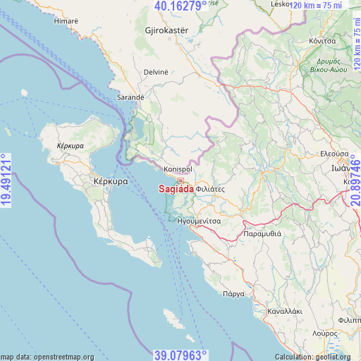
Sagiáda GPS coordinates[2]
39° 37' 23.988" North, 20° 11' 39.588" East
| Map corner | latitude | longitude |
|---|---|---|
| Upper-left | 40.16279°, | 19.49121° |
| Center: | 39.62333°, | 20.19433° |
| Lower-right: | 39.07963°, | 20.89746° |
| Map W x H: | 120.4×120.4 km | = 74.8×74.8mi |
| max Lat: | 41.72048° ⇑39.4% North |
| Sagiáda: | 39.62333° |
| min Lat: | ⇓60.6% South 34.8346° |
| min Long | Sagiáda | max Long |
| 19.40494° | 20.19433° | 29.59361° |
| W 2.6%⇐ | ⇒97.4% E |
Elevation
Elevation of Sagiáda is 14 m = 46 ft, and this is 154.9 m = 508 ft below average elevation for this country.
| Max E: |
1439 m = 4721 ft | 83.9% |
| Avg. | 168.9 m = 554 ft | |
| Sagiáda | 14 m = 46 ft | |
Min E: |
0 m = 0 ft | 16.1% |
See also: Greece elevation on elevation.city.
Geographical zone
Sagiáda is located in North temperate zone (between Tropic of Cancer and the Arctic Circle). Distance of this Northern Tropic circle is 1799.8 km =1118.3 mi to South.| Distance of | km | miles | from Sagiáda |
|---|---|---|---|
| North Pole | 5601.4 | 3480.5 | to North |
| Arctic Circle | 2995.5 | 1861.3 | to North |
| Tropic Cancer | 1799.8 | 1118.3 | to South |
| Equator | 4405.7 | 2737.6 | to South |


Nearby cities:
15 places around Sagiáda: (largest is in red/bold)
• Alepoú
25.6 km =15.9 mi,  268°
268°
• Benítses
25.6 km =15.9 mi,  249°
249°
• Chrysiída
25.7 km =16 mi,  261°
261°
• Corfu
23.5 km =14.6 mi, 269°
• Filiátes
10.4 km =6.5 mi,  103°
103°
• Graikochóri
15.6 km =9.7 mi,  153°
153°
• Igoumenítsa
14.7 km =9.1 mi, 154°
• Kastrí
10.4 km =6.5 mi,  139°
139°
• Lefkímmi
24.6 km =15.3 mi,  205°
205°
• Néa Seléfkeia
12.2 km =7.6 mi, 154°
• Parapótamos
13.9 km =8.6 mi,  126°
126°
• Perama
24.6 km =15.3 mi, 259°
• Petrití
25.3 km =15.7 mi,  221°
221°
• Platariá
20.5 km =12.7 mi,  159°
159°
• Sývota
24.5 km =15.2 mi,  169°
169°
Sources, notices
• [Note1] Compared only with cities in Greece existing in our database
• [Src1] Map data: © OpenStreetMap contributors (CC-BY-SA)
• [Src2] Other city data from geonames.org with taken over terms of usage.
• [Src3] Geographical zone / Annual Mean Temperature by Robert A. Rohde @ Wikipedia
