Rízoma geodata
Rízoma (Thessaly) is a populated place; located in Greece in Europe/Athens (GMT+3) time zone. With population of 1,410 people, there are 717 cities with bigger population in this country. Compared to other cities in Greece, 61.9% of cities are located further ↓South; 77.7% of cities are located further →East and 68.5% of cities have lower elevation than Rízoma. Note1


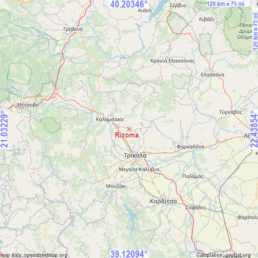
Rízoma GPS coordinates[2]
39° 39' 51.552" North, 21° 44' 7.476" East
| Map corner | latitude | longitude |
|---|---|---|
| Upper-left | 40.20346°, | 21.03229° |
| Center: | 39.66432°, | 21.73541° |
| Lower-right: | 39.12094°, | 22.43854° |
| Map W x H: | 120.4×120.4 km | = 74.8×74.8mi |
| max Lat: | 41.72048° ⇑38.1% North |
| Rízoma: | 39.66432° |
| min Lat: | ⇓61.9% South 34.8346° |
| min Long | Rízoma | max Long |
| 19.40494° | 21.73541° | 29.59361° |
| W 22.3%⇐ | ⇒77.7% E |
Elevation
Elevation of Rízoma is 155 m = 509 ft, and this is 13.9 m = 46 ft below average elevation for this country.
| Max E: |
1439 m = 4721 ft | 31.5% |
| Avg. | 168.9 m = 554 ft | |
| Rízoma | 155 m = 509 ft | |
Min E: |
0 m = 0 ft | 68.5% |
See also: Greece elevation on elevation.city.
Geographical zone
Rízoma is located in North temperate zone (between Tropic of Cancer and the Arctic Circle). Distance of this Northern Tropic circle is 1804.3 km =1121.1 mi to South.| Distance of | km | miles | from Rízoma |
|---|---|---|---|
| North Pole | 5596.8 | 3477.7 | to North |
| Arctic Circle | 2990.9 | 1858.5 | to North |
| Tropic Cancer | 1804.3 | 1121.1 | to South |
| Equator | 4410.3 | 2740.4 | to South |


Nearby cities:
15 places around Rízoma: (largest is in red/bold)
• Ardáni
5.7 km =3.5 mi,  129°
129°
• Dialektó
10.5 km =6.5 mi,  222°
222°
• Kalampáka
10.3 km =6.4 mi,  295°
295°
• Kastráki
11.6 km =7.2 mi, 300°
• Kefalóvryso
10 km =6.2 mi,  201°
201°
• Megárchis
9.9 km =6.2 mi,  232°
232°
• Méga Kefalóvryso
8.4 km =5.2 mi,  184°
184°
• Palaiópyrgos
9.4 km =5.8 mi, 131°
• Plátanos
2.9 km =1.8 mi,  98°
98°
• Ráxa
6.1 km =3.8 mi,  170°
170°
• Theópetra
4.5 km =2.8 mi,  283°
283°
• Tríkala
12.5 km =7.8 mi, 166°
• Vasilikí
3.8 km =2.4 mi, 224°
• Zileftí
11.2 km =7 mi,  140°
140°
• Ávra
6.5 km =4 mi,  323°
323°
Sources, notices
• [Note1] Compared only with cities in Greece existing in our database
• [Src1] Map data: © OpenStreetMap contributors (CC-BY-SA)
• [Src2] Other city data from geonames.org with taken over terms of usage.
• [Src3] Geographical zone / Annual Mean Temperature by Robert A. Rohde @ Wikipedia
