Gáïos geodata
Gáïos (Ionian Islands) is a seat of a third-order administrative division; located in Greece in Europe/Athens (GMT+3) time zone. With population of 487 people, there are 1805 cities with bigger population in this country. Compared to other cities in Greece, 50.4% of cities are located further ↑North; 97.5% of cities are located further →East and 97.4% of cities have higher elevation than Gáïos. Note1


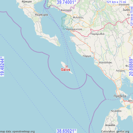
Gáïos GPS coordinates[2]
39° 11' 49.992" North, 20° 11' 8.016" East
| Map corner | latitude | longitude |
|---|---|---|
| Upper-left | 39.74001°, | 19.48244° |
| Center: | 39.19722°, | 20.18556° |
| Lower-right: | 38.65021°, | 20.88869° |
| Map W x H: | 121.2×121.2 km | = 75.3×75.3mi |
| max Lat: | 41.72048° ⇑50.4% North |
| Gáïos: | 39.19722° |
| min Lat: | ⇓49.6% South 34.8346° |
| min Long | Gáïos | max Long |
| 19.40494° | 20.18556° | 29.59361° |
| W 2.5%⇐ | ⇒97.5% E |
Elevation
Elevation of Gáïos is 4 m = 13 ft, and this is 164.9 m = 541 ft below average elevation for this country.
| Max E: |
1439 m = 4721 ft | 97.4% |
| Avg. | 168.9 m = 554 ft | |
| Gáïos | 4 m = 13 ft | |
Min E: |
0 m = 0 ft | 2.6% |
See also: Greece elevation on elevation.city.
Geographical zone
Gáïos is located in North temperate zone (between Tropic of Cancer and the Arctic Circle). Distance of this Northern Tropic circle is 1752.4 km =1088.9 mi to South.| Distance of | km | miles | from Gáïos |
|---|---|---|---|
| North Pole | 5648.7 | 3509.9 | to North |
| Arctic Circle | 3042.9 | 1890.8 | to North |
| Tropic Cancer | 1752.4 | 1088.9 | to South |
| Equator | 4358.3 | 2708.1 | to South |


Nearby cities:
15 places around Gáïos: (largest is in red/bold)
• Agios Geórgios Argyrádon
32.7 km =20.3 mi,  321°
321°
• Agiá
19.7 km =12.2 mi,  49°
49°
• Anthoúsa
19.7 km =12.2 mi, 54°
• Argyrádes
32 km =19.9 mi,  325°
325°
• Kávos
22.5 km =14 mi,  342°
342°
• Lefkímmi
27 km =16.8 mi, 338°
• Margaríti
28.2 km =17.5 mi, 50°
• Mazarakiá
29.5 km =18.3 mi,  33°
33°
• Mesopótamo
30 km =18.6 mi,  81°
81°
• Perivóli
28.7 km =17.8 mi, 329°
• Petrití
32.7 km =20.3 mi, 330°
• Platariá
29.3 km =18.2 mi,  15°
15°
• Párga
21 km =13 mi,  61°
61°
• Pérdika
21.7 km =13.5 mi, 28°
• Sývota
24 km =14.9 mi,  13°
13°
Sources, notices
• [Note1] Compared only with cities in Greece existing in our database
• [Src1] Map data: © OpenStreetMap contributors (CC-BY-SA)
• [Src2] Other city data from geonames.org with taken over terms of usage.
• [Src3] Geographical zone / Annual Mean Temperature by Robert A. Rohde @ Wikipedia
