Neochórion geodata
Neochórion (West Greece) is a populated place; located in Greece in Europe/Athens (GMT+3) time zone. With population of 2,827 people, there are 371 cities with bigger population in this country. Compared to other cities in Greece, 63.6% of cities are located further ↑North; 86.6% of cities are located further →East and 94.2% of cities have higher elevation than Neochórion. Note1
Administrative division(s):
- Level 1: West Greece
- Level 2: Nomós Aitolías kai Akarnanías
- Level 3: Dimos Missolonghi


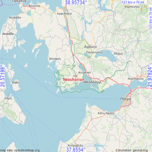
Neochórion GPS coordinates[2]
38° 24' 30.492" North, 21° 16' 30.396" East
| Map corner | latitude | longitude |
|---|---|---|
| Upper-left | 38.95734°, | 20.57199° |
| Center: | 38.40847°, | 21.27511° |
| Lower-right: | 37.8554°, | 21.97824° |
| Map W x H: | 122.5×122.5 km | = 76.1×76.1mi |
| max Lat: | 41.72048° ⇑63.6% North |
| Neochórion: | 38.40847° |
| min Lat: | ⇓36.4% South 34.8346° |
| min Long | Neochórion | max Long |
| 19.40494° | 21.27511° | 29.59361° |
| W 13.4%⇐ | ⇒86.6% E |
Elevation
Elevation of Neochórion is 6 m = 20 ft, and this is 162.9 m = 534 ft below average elevation for this country.
| Max E: |
1439 m = 4721 ft | 94.2% |
| Avg. | 168.9 m = 554 ft | |
| Neochórion | 6 m = 20 ft | |
Min E: |
0 m = 0 ft | 5.8% |
See also: Greece elevation on elevation.city.
Geographical zone
Neochórion is located in North temperate zone (between Tropic of Cancer and the Arctic Circle). Distance of this Northern Tropic circle is 1664.7 km =1034.4 mi to South.| Distance of | km | miles | from Neochórion |
|---|---|---|---|
| North Pole | 5736.4 | 3564.4 | to North |
| Arctic Circle | 3130.6 | 1945.3 | to North |
| Tropic Cancer | 1664.7 | 1034.4 | to South |
| Equator | 4270.6 | 2653.6 | to South |


Nearby cities:
15 places around Neochórion: (largest is in red/bold)
• Aitolikó
7.5 km =4.7 mi,  65°
65°
• Angelókastro
17.6 km =10.9 mi,  6°
6°
• Astakós
22 km =13.7 mi,  309°
309°
• Gouriá
7.3 km =4.5 mi,  350°
350°
• Grammatikoú
24.1 km =15 mi,  56°
56°
• Kalývia
23.3 km =14.5 mi,  3°
3°
• Katochí
2 km =1.2 mi,  282°
282°
• Lesíni
6.1 km =3.8 mi,  322°
322°
• Mataránga
21.5 km =13.4 mi,  53°
53°
• Mesolóngi
14.2 km =8.8 mi,  106°
106°
• Palaiománina
16.3 km =10.1 mi, 349°
• Pappadhátai
20.2 km =12.6 mi, 48°
• Pendálofon
8.8 km =5.5 mi,  343°
343°
• Stamná
11.8 km =7.3 mi, 2°
• Zevgarákion
18.7 km =11.6 mi,  40°
40°
Sources, notices
• [Note1] Compared only with cities in Greece existing in our database
• [Src1] Map data: © OpenStreetMap contributors (CC-BY-SA)
• [Src2] Other city data from geonames.org with taken over terms of usage.
• [Src3] Geographical zone / Annual Mean Temperature by Robert A. Rohde @ Wikipedia
