Mesolóngi geodata
Mesolóngi (West Greece) is a seat of a second-order administrative division; located in Greece in Europe/Athens (GMT+3) time zone. With population of 12,785 people, there are 122 cities with bigger population in this country. Compared to other cities in Greece, 64.3% of cities are located further ↑North; 84% of cities are located further →East and 98.4% of cities have higher elevation than Mesolóngi. Note1
Administrative division(s):
- Level 1: West Greece
- Level 2: Nomós Aitolías kai Akarnanías
- Level 3: Dimos Missolonghi


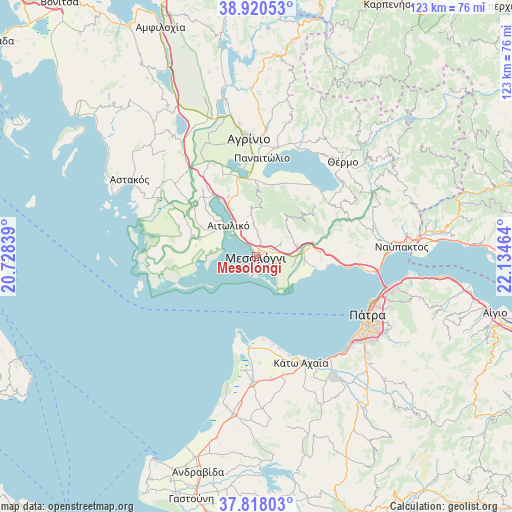
Mesolóngi GPS coordinates[2]
38° 22' 16.968" North, 21° 25' 53.436" East
| Map corner | latitude | longitude |
|---|---|---|
| Upper-left | 38.92053°, | 20.72839° |
| Center: | 38.37138°, | 21.43151° |
| Lower-right: | 37.81803°, | 22.13464° |
| Map W x H: | 122.6×122.6 km | = 76.2×76.2mi |
| max Lat: | 41.72048° ⇑64.3% North |
| Mesolóngi: | 38.37138° |
| min Lat: | ⇓35.7% South 34.8346° |
| min Long | Mesolóngi | max Long |
| 19.40494° | 21.43151° | 29.59361° |
| W 16%⇐ | ⇒84% E |
Elevation
Elevation of Mesolóngi is 3 m = 10 ft, and this is 165.9 m = 544 ft below average elevation for this country.
| Max E: |
1439 m = 4721 ft | 98.4% |
| Avg. | 168.9 m = 554 ft | |
| Mesolóngi | 3 m = 10 ft | |
Min E: |
0 m = 0 ft | 1.6% |
See also: Greece elevation on elevation.city.
Geographical zone
Mesolóngi is located in North temperate zone (between Tropic of Cancer and the Arctic Circle). Distance of this Northern Tropic circle is 1660.6 km =1031.8 mi to South.| Distance of | km | miles | from Mesolóngi |
|---|---|---|---|
| North Pole | 5740.6 | 3567 | to North |
| Arctic Circle | 3134.7 | 1947.8 | to North |
| Tropic Cancer | 1660.6 | 1031.8 | to South |
| Equator | 4266.5 | 2651.1 | to South |


Nearby cities:
15 places around Mesolóngi: (largest is in red/bold)
• Aitolikó
10 km =6.2 mi,  317°
317°
• Galatás
11.5 km =7.1 mi,  97°
97°
• Gavaloú
19.6 km =12.2 mi,  26°
26°
• Gouriá
18.6 km =11.6 mi,  307°
307°
• Grammatikoú
18.6 km =11.6 mi,  20°
20°
• Katochí
16.2 km =10.1 mi,  286°
286°
• Káto Makrinoú
21.2 km =13.2 mi,  52°
52°
• Lesíni
19.5 km =12.1 mi,  297°
297°
• Mataránga
17.3 km =10.7 mi,  12°
12°
• Neochórion
14.2 km =8.8 mi, 286°
• Pappadhátai
17.5 km =10.9 mi, 5°
• Pendálofon
20.4 km =12.7 mi, 308°
• Stamná
20.5 km =12.7 mi, 320°
• Zevgarákion
18.5 km =11.5 mi,  355°
355°
• Áyios Andréas
20.3 km =12.6 mi, 31°
Sources, notices
• [Note1] Compared only with cities in Greece existing in our database
• [Src1] Map data: © OpenStreetMap contributors (CC-BY-SA)
• [Src2] Other city data from geonames.org with taken over terms of usage.
• [Src3] Geographical zone / Annual Mean Temperature by Robert A. Rohde @ Wikipedia
