Malakási geodata
Malakási (Thessaly) is a populated place; located in Greece in Europe/Athens (GMT+3) time zone. With population of 513 people, there are 1784 cities with bigger population in this country. Compared to other cities in Greece, 64.2% of cities are located further ↓South; 86.4% of cities are located further →East and 98.4% of cities have lower elevation than Malakási. Note1


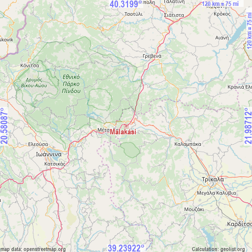
Malakási GPS coordinates[2]
39° 46' 54.048" North, 21° 17' 2.364" East
| Map corner | latitude | longitude |
|---|---|---|
| Upper-left | 40.3199°, | 20.58087° |
| Center: | 39.78168°, | 21.28399° |
| Lower-right: | 39.23922°, | 21.98712° |
| Map W x H: | 120.2×120.2 km | = 74.7×74.7mi |
| max Lat: | 41.72048° ⇑35.8% North |
| Malakási: | 39.78168° |
| min Lat: | ⇓64.2% South 34.8346° |
| min Long | Malakási | max Long |
| 19.40494° | 21.28399° | 29.59361° |
| W 13.6%⇐ | ⇒86.4% E |
Elevation
Elevation of Malakási is 879 m = 2884 ft, and this is 710.1 m = 2330 ft above average elevation for this country.
| Max E: |
1439 m = 4721 ft | 1.6% |
| Malakási | 879 m 2884 ft | |
| Avg. | 168.9 m = 554 ft | |
Min E: |
0 m = 0 ft | 98.4% |
See also: Greece elevation on elevation.city.
Geographical zone
Malakási is located in North temperate zone (between Tropic of Cancer and the Arctic Circle). Distance of this Northern Tropic circle is 1817.4 km =1129.3 mi to South.| Distance of | km | miles | from Malakási |
|---|---|---|---|
| North Pole | 5583.8 | 3469.6 | to North |
| Arctic Circle | 2977.9 | 1850.4 | to North |
| Tropic Cancer | 1817.4 | 1129.3 | to South |
| Equator | 4423.3 | 2748.5 | to South |


Nearby cities:
15 places around Malakási: (largest is in red/bold)
• Agiófyllo
25.4 km =15.8 mi,  69°
69°
• Agnantiá
18.2 km =11.3 mi,  58°
58°
• Anílio
8.5 km =5.3 mi,  253°
253°
• Chrysomiliá
26.8 km =16.7 mi,  136°
136°
• Diáva
27.3 km =17 mi,  111°
111°
• Drosochóri
31.7 km =19.7 mi,  237°
237°
• Kalampáka
30.6 km =19 mi, 106°
• Kalomoíra
11.4 km =7.1 mi, 107°
• Kastráki
29.5 km =18.3 mi,  104°
104°
• Kraniá
12.8 km =8 mi,  358°
358°
• Longádes
32.5 km =20.2 mi, 245°
• Melissourgoí
32.6 km =20.3 mi,  201°
201°
• Metsovo
8.8 km =5.5 mi,  261°
261°
• Oxýneia
18.3 km =11.4 mi, 74°
• Panagía
4.2 km =2.6 mi, 67°
Sources, notices
• [Note1] Compared only with cities in Greece existing in our database
• [Src1] Map data: © OpenStreetMap contributors (CC-BY-SA)
• [Src2] Other city data from geonames.org with taken over terms of usage.
• [Src3] Geographical zone / Annual Mean Temperature by Robert A. Rohde @ Wikipedia
