Agiófyllo geodata
Agiófyllo (Thessaly) is a populated place; located in Greece in Europe/Athens (GMT+3) time zone. With population of 621 people, there are 1546 cities with bigger population in this country. Compared to other cities in Greece, 65.2% of cities are located further ↓South; 81.8% of cities are located further →East and 92.4% of cities have lower elevation than Agiófyllo. Note1


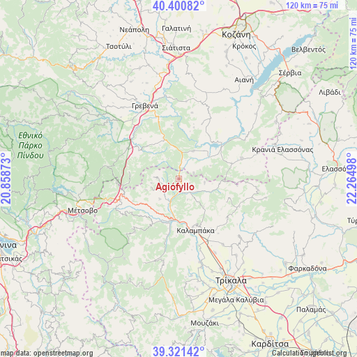
Agiófyllo GPS coordinates[2]
39° 51' 47.664" North, 21° 33' 42.66" East
| Map corner | latitude | longitude |
|---|---|---|
| Upper-left | 40.40082°, | 20.85873° |
| Center: | 39.86324°, | 21.56185° |
| Lower-right: | 39.32142°, | 22.26498° |
| Map W x H: | 120×120 km | = 74.6×74.6mi |
| max Lat: | 41.72048° ⇑34.8% North |
| Agiófyllo: | 39.86324° |
| min Lat: | ⇓65.2% South 34.8346° |
| min Long | Agiófyllo | max Long |
| 19.40494° | 21.56185° | 29.59361° |
| W 18.2%⇐ | ⇒81.8% E |
Elevation
Elevation of Agiófyllo is 589 m = 1932 ft, and this is 420.1 m = 1378 ft above average elevation for this country.
| Max E: |
1439 m = 4721 ft | 7.6% |
| Agiófyllo | 589 m 1932 ft | |
| Avg. | 168.9 m = 554 ft | |
Min E: |
0 m = 0 ft | 92.4% |
See also: Greece elevation on elevation.city.
Geographical zone
Agiófyllo is located in North temperate zone (between Tropic of Cancer and the Arctic Circle). Distance of this Northern Tropic circle is 1826.5 km =1134.9 mi to South.| Distance of | km | miles | from Agiófyllo |
|---|---|---|---|
| North Pole | 5574.7 | 3464 | to North |
| Arctic Circle | 2968.8 | 1844.7 | to North |
| Tropic Cancer | 1826.5 | 1134.9 | to South |
| Equator | 4432.4 | 2754.2 | to South |


Nearby cities:
15 places around Agiófyllo: (largest is in red/bold)
• Agnantiá
8.2 km =5.1 mi,  273°
273°
• Asprokklisiá
8.8 km =5.5 mi,  99°
99°
• Deskáti
22.3 km =13.9 mi,  72°
72°
• Diáva
19 km =11.8 mi,  175°
175°
• Dímitra
12.6 km =7.8 mi,  42°
42°
• Kalampáka
18.5 km =11.5 mi,  162°
162°
• Kalomoíra
18 km =11.2 mi,  225°
225°
• Karperó
10.5 km =6.5 mi,  27°
27°
• Kastráki
17 km =10.6 mi, 163°
• Kraniá
24.2 km =15 mi,  278°
278°
• Malakási
25.4 km =15.8 mi,  249°
249°
• Oxýneia
7.4 km =4.6 mi,  236°
236°
• Panagía
21.2 km =13.2 mi, 249°
• Theópetra
23.5 km =14.6 mi,  153°
153°
• Ávra
20.2 km =12.6 mi, 146°
Sources, notices
• [Note1] Compared only with cities in Greece existing in our database
• [Src1] Map data: © OpenStreetMap contributors (CC-BY-SA)
• [Src2] Other city data from geonames.org with taken over terms of usage.
• [Src3] Geographical zone / Annual Mean Temperature by Robert A. Rohde @ Wikipedia
