Tragána geodata
Tragána (Central Greece) is a populated place; located in Greece in Europe/Athens (GMT+3) time zone. With population of 864 people, there are 1182 cities with bigger population in this country. Compared to other cities in Greece, 59.5% of cities are located further ↑North; 57.3% of cities are located further ←West and 74.1% of cities have higher elevation than Tragána. Note1


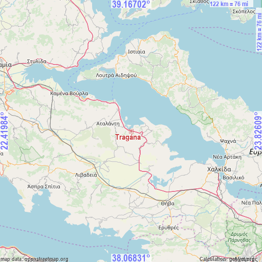
Tragána GPS coordinates[2]
38° 37' 11.172" North, 23° 7' 22.656" East
| Map corner | latitude | longitude |
|---|---|---|
| Upper-left | 39.16702°, | 22.41984° |
| Center: | 38.61977°, | 23.12296° |
| Lower-right: | 38.06831°, | 23.82609° |
| Map W x H: | 122.2×122.2 km | = 75.9×75.9mi |
| max Lat: | 41.72048° ⇑59.5% North |
| Tragána: | 38.61977° |
| min Lat: | ⇓40.5% South 34.8346° |
| min Long | Tragána | max Long |
| 19.40494° | 23.12296° | 29.59361° |
| W 57.3%⇐ | ⇒42.7% E |
Elevation
Elevation of Tragána is 25 m = 82 ft, and this is 143.9 m = 472 ft below average elevation for this country.
| Max E: |
1439 m = 4721 ft | 74.1% |
| Avg. | 168.9 m = 554 ft | |
| Tragána | 25 m = 82 ft | |
Min E: |
0 m = 0 ft | 25.9% |
See also: Greece elevation on elevation.city.
Geographical zone
Tragána is located in North temperate zone (between Tropic of Cancer and the Arctic Circle). Distance of this Northern Tropic circle is 1688.2 km =1049 mi to South.| Distance of | km | miles | from Tragána |
|---|---|---|---|
| North Pole | 5712.9 | 3549.8 | to North |
| Arctic Circle | 3107.1 | 1930.7 | to North |
| Tropic Cancer | 1688.2 | 1049 | to South |
| Equator | 4294.1 | 2668.2 | to South |


Nearby cities:
15 places around Tragána: (largest is in red/bold)
• Akraifnía
20 km =12.4 mi,  154°
154°
• Arkítsa
15.8 km =9.8 mi,  330°
330°
• Atalánti
11.3 km =7 mi,  287°
287°
• Kástron
14.4 km =8.9 mi,  167°
167°
• Kókkinon
19 km =11.8 mi, 147°
• Livanátes
11.9 km =7.4 mi, 328°
• Loutrá Aidhipsoú
27.2 km =16.9 mi,  346°
346°
• Lárimna
15.3 km =9.5 mi,  113°
113°
• Límni
23.4 km =14.5 mi,  45°
45°
• Malesína
9.6 km =6 mi,  88°
88°
• Martínon
9.8 km =6.1 mi,  125°
125°
• Orchomenós
18.8 km =11.7 mi,  221°
221°
• Roviés
23.1 km =14.4 mi,  23°
23°
• Zéli
22 km =13.7 mi,  281°
281°
• Éxarkhos
15.9 km =9.9 mi,  257°
257°
Sources, notices
• [Note1] Compared only with cities in Greece existing in our database
• [Src1] Map data: © OpenStreetMap contributors (CC-BY-SA)
• [Src2] Other city data from geonames.org with taken over terms of usage.
• [Src3] Geographical zone / Annual Mean Temperature by Robert A. Rohde @ Wikipedia
