Kýthira geodata
Kýthira (Attica) is a seat of a third-order administrative division; located in Greece in Europe/Athens (GMT+3) time zone. With population of 281 people, there are 1812 cities with bigger population in this country. Compared to other cities in Greece, 93.5% of cities are located further ↑North; 54.7% of cities are located further ←West and 64.1% of cities have lower elevation than Kýthira. Note1


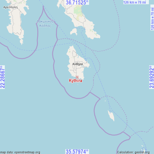
Kýthira GPS coordinates[2]
36° 8' 58.38" North, 22° 59' 23.244" East
| Map corner | latitude | longitude |
|---|---|---|
| Upper-left | 36.71525°, | 22.28667° |
| Center: | 36.14955°, | 22.98979° |
| Lower-right: | 35.57974°, | 23.69292° |
| Map W x H: | 126.3×126.3 km | = 78.5×78.5mi |
| max Lat: | 41.72048° ⇑93.5% North |
| Kýthira: | 36.14955° |
| min Lat: | ⇓6.5% South 34.8346° |
| min Long | Kýthira | max Long |
| 19.40494° | 22.98979° | 29.59361° |
| W 54.7%⇐ | ⇒45.3% E |
Elevation
Elevation of Kýthira is 137 m = 449 ft, and this is 31.9 m = 105 ft below average elevation for this country.
| Max E: |
1439 m = 4721 ft | 35.9% |
| Avg. | 168.9 m = 554 ft | |
| Kýthira | 137 m = 449 ft | |
Min E: |
0 m = 0 ft | 64.1% |
See also: Greece elevation on elevation.city.
Geographical zone
Kýthira is located in North temperate zone (between Tropic of Cancer and the Arctic Circle). Distance of this Northern Tropic circle is 1413.5 km =878.3 mi to South.| Distance of | km | miles | from Kýthira |
|---|---|---|---|
| North Pole | 5987.6 | 3720.5 | to North |
| Arctic Circle | 3381.7 | 2101.3 | to North |
| Tropic Cancer | 1413.5 | 878.3 | to South |
| Equator | 4019.5 | 2497.6 | to South |


Nearby cities:
15 places around Kýthira: (largest is in red/bold)
• Areópoli
79.1 km =49.2 mi,  316°
316°
• Asopós
65.6 km =40.8 mi,  349°
349°
• Elafónisos
39.9 km =24.8 mi,  358°
358°
• Geráki
97.1 km =60.3 mi,  344°
344°
• Géfyra
59.9 km =37.2 mi,  3°
3°
• Gýtheio
77.3 km =48 mi,  330°
330°
• Krokeés
90.6 km =56.3 mi, 334°
• Káto Glykóvrysi
77.8 km =48.3 mi, 345°
• Kíssamos
94.3 km =58.6 mi,  140°
140°
• Moláoi
74.2 km =46.1 mi, 350°
• Plátanos
93.3 km =58 mi, 143°
• Skála
83.1 km =51.6 mi, 339°
• Sykiá
68.4 km =42.5 mi, 356°
• Vlachiótis
83 km =51.6 mi, 342°
• Élos
80.3 km =49.9 mi, 341°
Sources, notices
• [Note1] Compared only with cities in Greece existing in our database
• [Src1] Map data: © OpenStreetMap contributors (CC-BY-SA)
• [Src2] Other city data from geonames.org with taken over terms of usage.
• [Src3] Geographical zone / Annual Mean Temperature by Robert A. Rohde @ Wikipedia
