Amfilochía geodata
Amfilochía (West Greece) is a seat of a third-order administrative division; located in Greece in Europe/Athens (GMT+3) time zone. With population of 4,022 people, there are 279 cities with bigger population in this country. Compared to other cities in Greece, 56.5% of cities are located further ↑North; 88.3% of cities are located further →East and 50.3% of cities have higher elevation than Amfilochía. Note1
Administrative division(s):
- Level 1: West Greece
- Level 2: Nomós Aitolías kai Akarnanías
- Level 3: Dimos Amfilochia


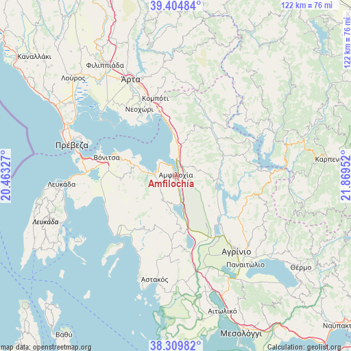
Amfilochía GPS coordinates[2]
38° 51' 33.984" North, 21° 9' 59.004" East
| Map corner | latitude | longitude |
|---|---|---|
| Upper-left | 39.40484°, | 20.46327° |
| Center: | 38.85944°, | 21.16639° |
| Lower-right: | 38.30982°, | 21.86952° |
| Map W x H: | 121.8×121.8 km | = 75.7×75.7mi |
| max Lat: | 41.72048° ⇑56.5% North |
| Amfilochía: | 38.85944° |
| min Lat: | ⇓43.5% South 34.8346° |
| min Long | Amfilochía | max Long |
| 19.40494° | 21.16639° | 29.59361° |
| W 11.7%⇐ | ⇒88.3% E |
Elevation
Elevation of Amfilochía is 80 m = 262 ft, and this is 88.9 m = 292 ft below average elevation for this country.
| Max E: |
1439 m = 4721 ft | 50.3% |
| Avg. | 168.9 m = 554 ft | |
| Amfilochía | 80 m = 262 ft | |
Min E: |
0 m = 0 ft | 49.7% |
See also: Greece elevation on elevation.city.
Geographical zone
Amfilochía is located in North temperate zone (between Tropic of Cancer and the Arctic Circle). Distance of this Northern Tropic circle is 1714.8 km =1065.5 mi to South.| Distance of | km | miles | from Amfilochía |
|---|---|---|---|
| North Pole | 5686.3 | 3533.3 | to North |
| Arctic Circle | 3080.4 | 1914.1 | to North |
| Tropic Cancer | 1714.8 | 1065.5 | to South |
| Equator | 4320.8 | 2684.8 | to South |


Nearby cities:
15 places around Amfilochía: (largest is in red/bold)
• Archontochóri
20.8 km =12.9 mi,  212°
212°
• Boúka
7.7 km =4.8 mi,  344°
344°
• Empesós
22.6 km =14 mi,  35°
35°
• Fyteíes
18.3 km =11.4 mi,  175°
175°
• Katoúna
9.4 km =5.8 mi, 208°
• Kríkellos
9.6 km =6 mi,  6°
6°
• Lepenoú
19.9 km =12.4 mi,  147°
147°
• Menídi
20.7 km =12.9 mi,  348°
348°
• Monastiráki
19.2 km =11.9 mi,  267°
267°
• Paliámpela
19.4 km =12.1 mi,  287°
287°
• Sardínia
4.8 km =3 mi,  45°
45°
• Spoláïta
23.9 km =14.9 mi,  139°
139°
• Stános
6.1 km =3.8 mi,  173°
173°
• Thýrio
16 km =9.9 mi, 268°
• Trýfos
8.9 km =5.5 mi,  242°
242°
Sources, notices
• [Note1] Compared only with cities in Greece existing in our database
• [Src1] Map data: © OpenStreetMap contributors (CC-BY-SA)
• [Src2] Other city data from geonames.org with taken over terms of usage.
• [Src3] Geographical zone / Annual Mean Temperature by Robert A. Rohde @ Wikipedia
