Sardínia geodata
Sardínia (West Greece) is a populated place; located in Greece in Europe/Athens (GMT+3) time zone. With population of 1,064 people, there are 948 cities with bigger population in this country. Compared to other cities in Greece, 56% of cities are located further ↑North; 87.6% of cities are located further →East and 53.1% of cities have lower elevation than Sardínia. Note1
Administrative division(s):
- Level 1: West Greece
- Level 2: Nomós Aitolías kai Akarnanías
- Level 3: Dimos Amfilochia


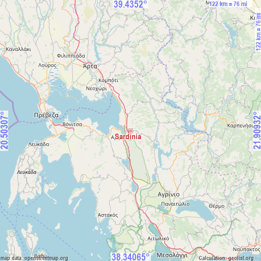
Sardínia GPS coordinates[2]
38° 53' 24.108" North, 21° 12' 22.284" East
| Map corner | latitude | longitude |
|---|---|---|
| Upper-left | 39.4352°, | 20.50307° |
| Center: | 38.89003°, | 21.20619° |
| Lower-right: | 38.34065°, | 21.90932° |
| Map W x H: | 121.7×121.7 km | = 75.6×75.6mi |
| max Lat: | 41.72048° ⇑56% North |
| Sardínia: | 38.89003° |
| min Lat: | ⇓44% South 34.8346° |
| min Long | Sardínia | max Long |
| 19.40494° | 21.20619° | 29.59361° |
| W 12.4%⇐ | ⇒87.6% E |
Elevation
Elevation of Sardínia is 93 m = 305 ft, and this is 75.9 m = 249 ft below average elevation for this country.
| Max E: |
1439 m = 4721 ft | 46.9% |
| Avg. | 168.9 m = 554 ft | |
| Sardínia | 93 m = 305 ft | |
Min E: |
0 m = 0 ft | 53.1% |
See also: Greece elevation on elevation.city.
Geographical zone
Sardínia is located in North temperate zone (between Tropic of Cancer and the Arctic Circle). Distance of this Northern Tropic circle is 1718.2 km =1067.6 mi to South.| Distance of | km | miles | from Sardínia |
|---|---|---|---|
| North Pole | 5682.9 | 3531.2 | to North |
| Arctic Circle | 3077 | 1912 | to North |
| Tropic Cancer | 1718.2 | 1067.6 | to South |
| Equator | 4324.2 | 2686.9 | to South |


Nearby cities:
15 places around Sardínia: (largest is in red/bold)
• Amfilochía
4.8 km =3 mi,  225°
225°
• Boúka
6.9 km =4.3 mi,  306°
306°
• Empesós
17.8 km =11.1 mi,  33°
33°
• Fyteíes
21.7 km =13.5 mi,  184°
184°
• Katoúna
14.1 km =8.8 mi,  214°
214°
• Komméno
23.1 km =14.4 mi,  319°
319°
• Kríkellos
6.6 km =4.1 mi,  339°
339°
• Lepenoú
21.5 km =13.4 mi,  160°
160°
• Menídi
18.5 km =11.5 mi, 335°
• Monastiráki
23.1 km =14.4 mi,  259°
259°
• Paliámpela
22.1 km =13.7 mi,  275°
275°
• Perdikáki
22.3 km =13.9 mi,  37°
37°
• Stános
9.9 km =6.2 mi,  196°
196°
• Thýrio
19.8 km =12.3 mi, 259°
• Trýfos
13.6 km =8.5 mi,  236°
236°
Sources, notices
• [Note1] Compared only with cities in Greece existing in our database
• [Src1] Map data: © OpenStreetMap contributors (CC-BY-SA)
• [Src2] Other city data from geonames.org with taken over terms of usage.
• [Src3] Geographical zone / Annual Mean Temperature by Robert A. Rohde @ Wikipedia
