Empesós geodata
Empesós (West Greece) is a populated place; located in Greece in Europe/Athens (GMT+3) time zone. With population of 598 people, there are 1582 cities with bigger population in this country. Compared to other cities in Greece, 54.4% of cities are located further ↑North; 85.8% of cities are located further →East and 81.2% of cities have lower elevation than Empesós. Note1
Administrative division(s):
- Level 1: West Greece
- Level 2: Nomós Aitolías kai Akarnanías
- Level 3: Dimos Amfilochia


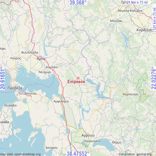
Empesós GPS coordinates[2]
39° 1' 25.932" North, 21° 19' 10.668" East
| Map corner | latitude | longitude |
|---|---|---|
| Upper-left | 39.568°, | 20.61651° |
| Center: | 39.02387°, | 21.31963° |
| Lower-right: | 38.47552°, | 22.02276° |
| Map W x H: | 121.5×121.5 km | = 75.5×75.5mi |
| max Lat: | 41.72048° ⇑54.4% North |
| Empesós: | 39.02387° |
| min Lat: | ⇓45.6% South 34.8346° |
| min Long | Empesós | max Long |
| 19.40494° | 21.31963° | 29.59361° |
| W 14.2%⇐ | ⇒85.8% E |
Elevation
Elevation of Empesós is 302 m = 991 ft, and this is 133.1 m = 437 ft above average elevation for this country.
| Max E: |
1439 m = 4721 ft | 18.8% |
| Empesós | 302 m 991 ft | |
| Avg. | 168.9 m = 554 ft | |
Min E: |
0 m = 0 ft | 81.2% |
See also: Greece elevation on elevation.city.
Geographical zone
Empesós is located in North temperate zone (between Tropic of Cancer and the Arctic Circle). Distance of this Northern Tropic circle is 1733.1 km =1076.9 mi to South.| Distance of | km | miles | from Empesós |
|---|---|---|---|
| North Pole | 5668 | 3521.9 | to North |
| Arctic Circle | 3062.1 | 1902.7 | to North |
| Tropic Cancer | 1733.1 | 1076.9 | to South |
| Equator | 4339 | 2696.1 | to South |


Nearby cities:
15 places around Empesós: (largest is in red/bold)
• Akropotamiá
27 km =16.8 mi,  286°
286°
• Amfilochía
22.6 km =14 mi,  215°
215°
• Boúka
18.8 km =11.7 mi,  234°
234°
• Komméno
25 km =15.5 mi,  275°
275°
• Kompóti
22.2 km =13.8 mi, 293°
• Kríkellos
15 km =9.3 mi, 234°
• Megárchi
25 km =15.5 mi,  300°
300°
• Menídi
17.5 km =10.9 mi, 276°
• Neochóri
26.5 km =16.5 mi, 281°
• Pachykálamos
27.2 km =16.9 mi, 284°
• Perdikáki
4.7 km =2.9 mi,  52°
52°
• Pétra
23.8 km =14.8 mi,  311°
311°
• Raptópoulo
19.6 km =12.2 mi,  44°
44°
• Sardínia
17.8 km =11.1 mi,  213°
213°
• Selládes
22.9 km =14.2 mi, 294°
Sources, notices
• [Note1] Compared only with cities in Greece existing in our database
• [Src1] Map data: © OpenStreetMap contributors (CC-BY-SA)
• [Src2] Other city data from geonames.org with taken over terms of usage.
• [Src3] Geographical zone / Annual Mean Temperature by Robert A. Rohde @ Wikipedia
